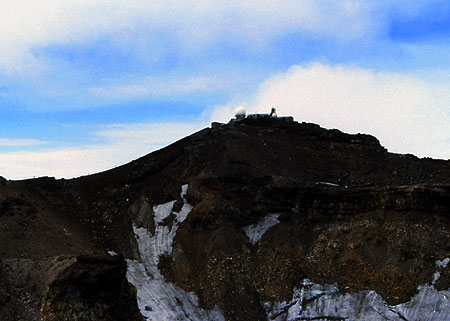
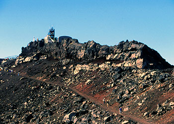
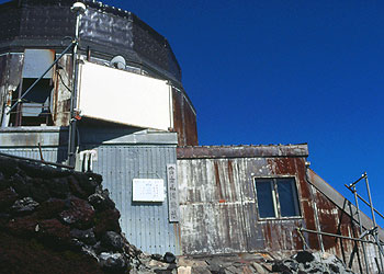
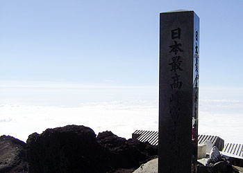
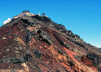
The highest peak of Mt.Fuji is Kengamine which 3776 meter sealevel belongs the highest point of Japan. A weather station had been built on the next to the summit on the purpose of mesuring weather condition of higher altitude. And a weather radar system covering almost over the land of Japan had put on the building in 1960s. We used to see the images obtained by Fujisan rader on the TV weather report program.
But satellites have gotten the role and it termed operation in 1999. Then white dome which was a symbol of Fujisan rader has been removed and also the weather station turned to unmaned operation.
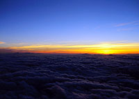
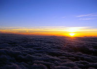
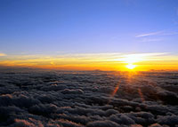
Goraiko. To see rising the sun at the summit is common pleasure of Japanese visitor. For this purpose, Over night climbing is usually selected. Although some visitors climb up during daytime and stay in a hut to wait the morning. Once, I have done that and learned that it's a terrible climing under the strong sunlight.
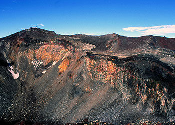
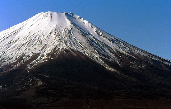
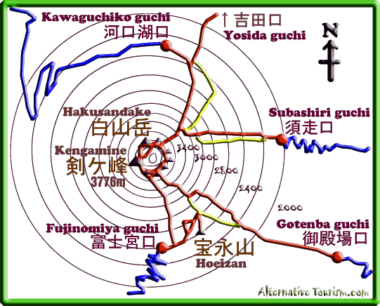
Since early times, Mt.Fuji has been beleaved as eight peaks being around the crater. And visiting all eight peaks called Ohatimawari. Although you will know it is difficult to count up to eight. Just Kengamine is intelligible peaks if you meet in front of it. Also second peak Hakusandake is easyly identified when you see the mountain from other mountains. But other moderate peaks must be difficult to identify even when you visit on there.
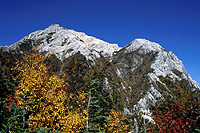
This photo was taken at the summit of Nakadake which belonges a group of the 3000 meter hight mountains so called Sourthern alps which located at the west of Mt.fuji. On the view from west,you may see twin peaks sit on the top. The left tip is consisted with Hakusandake and another peak actually located south side of the mountain is Kengamine.
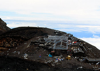
There are two groups of huts around summit area. First one is located the north tip of the crater wall which consisted with the end point of Kawaguchiko guchi trail.
Visitors of Subashiri guchi trail who started from the east side of the mountain also reaches here, since the trail joined 8th station of Kawaguchiko guchi trail. The sectionof trail to here become crowded much espaecially the time of sunrise because both visitors coming from two routes are added and hurried going up intime for sunrise .
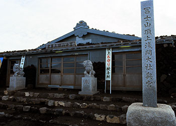
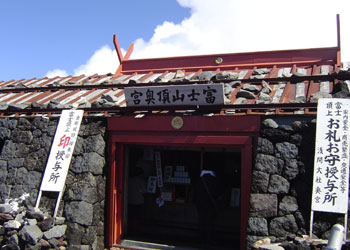
Another groups of huts are beside the Sengen shrine put on the south tip of the crater. It closes to the end of Fujinomiya guchi trail. Near there, Gotenba guchi trail is reached too.
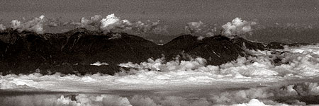
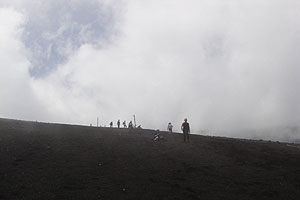
The top of the mountain gives extensive views from the reson of Mt. Fuji is stand alone volcanic mountain. There is 360 degree view in which the depth of senary reaches Tokyo metropolitan area are available in a fineday. Although it depend on your luck. It tends to be cloudy during the climbing season of the mountain.
There are many mountains which has the name postposing with the word Fuji in Japan. Usually these mountains give the best senary in the region. Mt.Fuji provides a ideal shape of mountain that neary all Japanese wish to see.
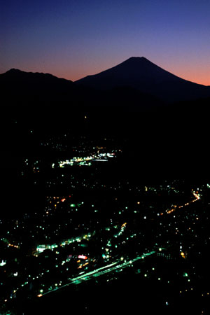
Mt.Fuji can be seen even from the urban area of Tokyo. It seems that it was a good backwall of old Tokyo which has contasted to low-rise wooden buildings roofed with kawara(tiles) untill the time of half a century ago. But today some difficulitis are resided on the view. Urban contaminated air restricts the distance for prospect, also a wall of concrete buildings may occlud the viewspan. However some time you are able to get the Fuji from there. An easy way to get is to visit an observation deck on skyscraper. If you have a chance to visit in a fine winter day, You will meet it.
Also you will take a good senary at the cities belonging to the west fringe of Tokyo area. At there, You may notice a trapezoidal shape is appeared on the skyline of mountains. Even you are in for a surprise when you are going to ride a train running in the region like as Ome-line also Hachiko-line. You can find that even on the Hachioji station on the JR Cyuoh-line in fine winter days.
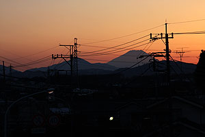
Fuji is seen at the Hachioji which is a city located on the west fringe of Tokyo area.
Another way to see Mt.Fuji is climbing up a summit of mountain sit on the west side of Tokyo. There are several mountains in the Okutama area. And many trails of there give a route for day walks. A railway connected to the region is JR Ome-line, and Ome-Tokkai(special rapid) trains which depart from Tokyo station run to the Ome station. By using this train, less two hours trip from the core staion of the metropolitan Tokyo, you will reach the Ome station at where you can change another train for Okutama station.
Ome is a city located west fringe of the Kanto plain and an entrance of the mountain area of Tokyo which called Okutama. Taking more 30 minuties on the train for Okutama, you will be in the last station Okutama. Okutama is a town spreading in mountains sit around the Tamagawa river. You can get a bus for the trailheads at the bus stops in front of the station.
I think the best peak for viewing Mt.Fuji on the area is Kumotoriyama which sit on the west tip of Tokyo and known as the highest point of Tokyo. However two days trip is needed for the summit. Another good view point for Fuji is near the top of Gozenyama. You may plan your schedule easily as a day trip because a route for the summit is starting at the Okutama station. Kumotori yama
Viewing from the peak Takanosuyama. The peak sit the mid point of the ridge which started at the south of Kumotoriyama and going to east toward the endpoint near the JR Okutama station.
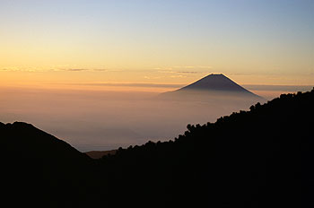
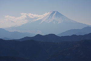
Mt.Fuji is also known as the mountain viewd from the coast line in Shizuoka prefecture. Most common one is a scenery on the window of Tokaido Shinkansen train. On the Shinkansen for Osaka direction, Mt.Fuji appers on the right side window from the Mishima station and going away after passing over Fujikawa river.
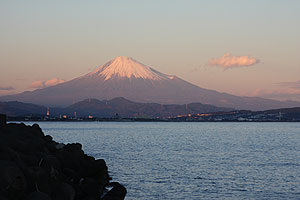
Mt.Fuji from Yaizuko port. Yaizuko is a fisherman port located on the west line of Surugawan bay. You must be identified a crater on the right shoulder in this view, which is made by the most recent erpution occured during the 17th century.
To climb the Mt. Fuji
It must be the surprising thing that just two days trip from Tokyo is enough for reaching the top of Japan. Mt.Fuji is known as the most accessible mountain for climbing over 3000 meters sea level summit in Japan. Because visitors can reduce the half of the elevation for climbing when they select a trail started from one of the 5th stations to where they can arrive by using bus.
Buses are only operated in the official climbing season of Mt.Fuji. It is opened from the first day of July and is closed the last day of August every year. You can take a bus for one of the 5th station of the trails from each entrance cities. Marvelously even highway bus from Shinjuku station where is in the core of Tokyo area operates for the Kawaguchiko 5th station that put on the north side of the mountain. Since Mt.Fuji area is relatively near from Tokyo, only 2.5 hours is needed for the station. Fujikyu bus co
Five routes are available now. Only Yoshida guchi trails starts at a town Fujiyoshida which is an entrance for the sightseeing Fuji-goko (five lakes) area which spreaded consisting the northern slope of Mt.Fuji. A railway campany Fujikyu line connects there with the Ohtuki station of JR Cyuoh line. Over six hours is needed for climbing to the branch at where the Kawaguchiko trail is joined after you walked out the Fuji-Yoshida station of the Fujikyu railway. Since the more time consumption, This route is rarely used. And instead of this, Most of visitors select routes which start from 5th climing stations. Fujikyu
The most popular route must be Kawaguchiko route. As I said the trail head of the Kawaguchiko route is conveniently connected to Tokyo with highway bus. Just after getting down from an air conditioned bus and you will start to walk, and soon you can join the Yoshida guchi trail which is become from the Fuji-Yoshida station as I mentioned. Following the trail and chasing after visitors, you will be in the summit area within five hours as usual.
Alternatively, Fujinomiya-guchi approached from the south side of the mountain is the choice frequently used especially visitors come from the west part of Japan. Shin-Fujinomiya station of the Tokaido-Shinkansen line is the entrance of the route. Buses from the Shizuoka station are operated too, although it's only in the high season (late July to mid August).
Fujikyu highway bus (Shizuoka station) Yamanashi bus (from Shizuoka station)Majority of the visitor choice one of these routes with the reason of both routes begin with more higher sea level than other two. As a result both routes are terribly crowed every weekend during the climbing season.
For avoiding this, I recommend to use the Subashiri-trail which is considered as relatively minor route. Although, the Subashiri trail will join the Yoshida trail at the 8th station and this last part of the trail toward the summit is most crowded just before sunrise. Despite the unpleasant last of the trail, I feel appreciate for use this toute by reson of easier ascent provided rather than Gotenba guchi trail which almost parallel with the route.
Gotenba trail is the longest course of four because the trail starts at 1400 meter sealevel. It means that you have to get more elevation by yourself. However, it is the preferable choice for descending. The sand track named Sunabashiri(means running on the sand) is famous, where it gives you the feeling of increasing the length of your stride.
The entrance city for both Subashiri and Gotenba trails is Gotenba city located in the east side of the mountain. In front of the JR Gotenba station, you will be able to take a scheduled bus (Tazan-bus) for each trail. Although, these buses are operated with out frequently. Taking a taxi at the station is convenient instead of waiting the these Tozan buses Tozan bus
The JR Gotenba line connects the JR Kohzu station and JR Numazu station with detour route via Gotenba. Since both ends of the line are belonged to the JR Tokaido line, you may approach there by using a JR train from Tokyo area.
Since Odakyu line crosses the Gotenba line at near Shinmatuda station, you can use the line for approaching the Gotenba line. JR and Odakyu-railway jointly operate several express trains for the Gotenba station, which run from the Odakyu-Shinjuku station. Be care about these express trains are not from JR Shinjuku station.
Odakyu Electric RailwayMaps
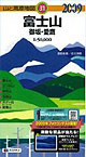
Because very clear tracks are found and so many people try to climb up in the season, so I can say that you don't need to seek a map. I think a free map from the tourism information is enough for this role.But if you want more precise one, You will be able to purchase 1/25000 scaled geographical maps printed by GSI at the large book stores in Tokyo or other large cities. Various maps for hiker which published by private companies are also easy to find at the book stores in large cities.
Guide book
'Lonly planet Hiking in Japan' can be usefull. You may buy this at Amazon.com or at www.amazon.co.jp .
Web
Online resources for Tourism in Japan Links I chose miscellaneous web resources for tourism in Japan. e.g. transportation, weather forcast and map publisher.