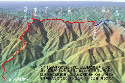
Wakwak Group couldn't make scheduled climbing in June and August due to unusual weather. In September, they finally made it by attacking Mt. Utsugi (2,864m) after walking along the ridge of a mountain Range of Central Japan Alps. They have tried in 2002 but stopped it due to bad weather.
Red Route
First Day, September 16, 2003
As usual, they arrived at the bottom of the Senjyoujiki Cur (2,600m) by Ropeway. Within an hour, they have arrived Hoken Hut.
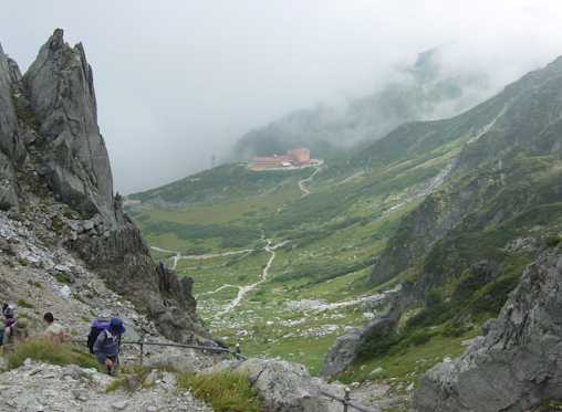
Looking Down Senjyojiki Curl
After the rest at the hut, they climbed Mt. Hoken.
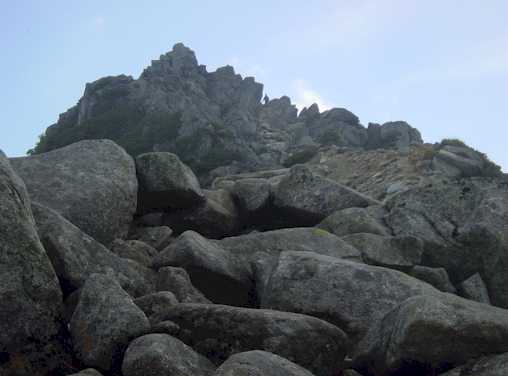
The Peak of Mt. Hoken
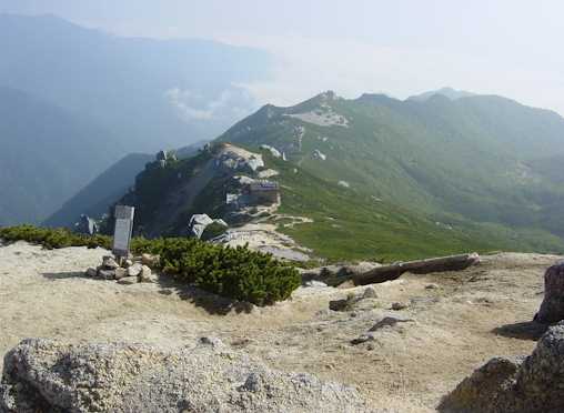
From the top of Mt. Hoken, you can see Hoken hut (blue roof) and Tengu Hut (red roof).
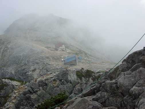
Looking down Hoken Hut from the Mt. Hoken
Second Day, September 17, 2003
After over night rest at Hoken Hut, they had started waking towards Mt. Utsugi which is visible far beyond in a clear morning air.
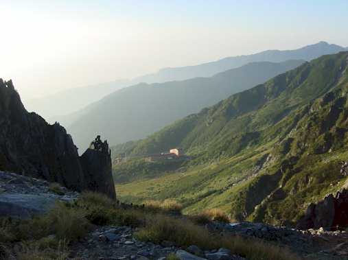
The view of Mt. Utsugi far beyond
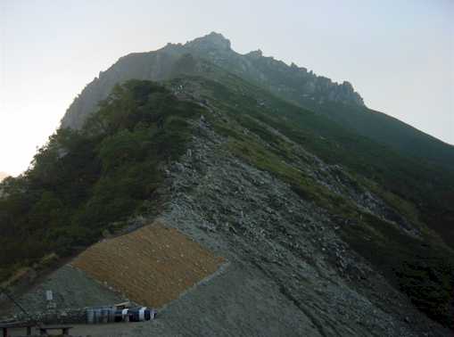
They descended to the bottom of Senjyoujiki Curl and climbed again up to Gokuraku Daira.
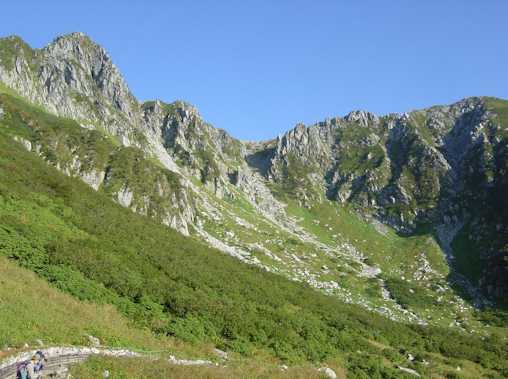
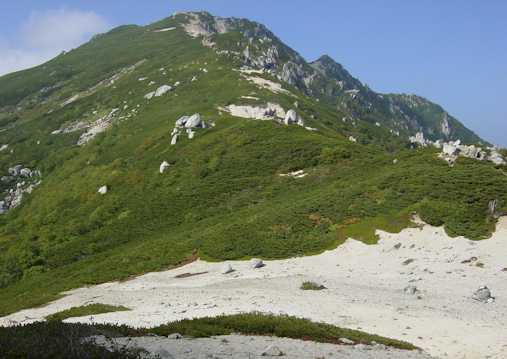
Senjyojiki Curl
from left Mt. Kisokomagatake, Mt. Nakadake, Mt. Hokendake (photo by Mr. Kuribayashi)
From the peak of the mountain range, you can see Mt. Nigorizawa Oomine(2,724m),Mt. Hinokio(2,728m)?Mt. Otaki, Mt. Kumazawa(2,778m) Mt. Higasikawa, Mt. Utsugi and Mt. Minamikomagatake.
Mountain Range of Central Japan Alps
After 11 hours and 30 minutes walk, they have arrived at Kisodono Hut. There they had a overnight rest.
Third Day, September 18, 2003
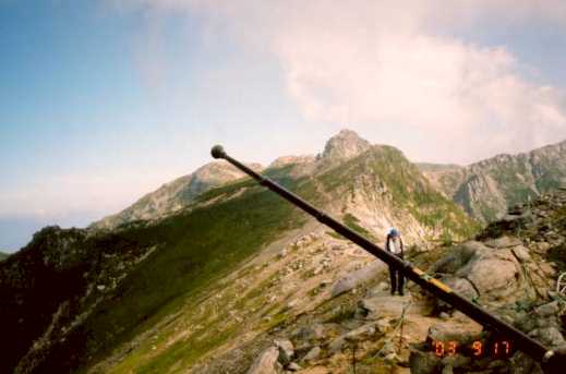
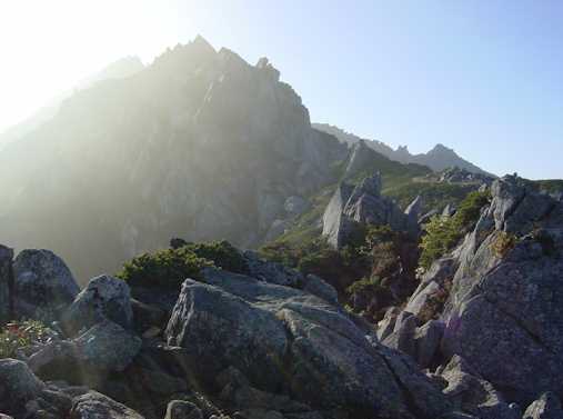
Before reaching the summit, you have to pass two steep peaks which is a mass of rocks. There is no other way than climb to come home.
First Peak of Mt. Utsugi
After 2 hours and 10 minutes struggle with steep slope and rock wall they have finally stood at the summit.
Second Peak of Mt. Utsugi Viewed from the Fist Peak
After brief rest, they started descending as they still have to descend almost 2,000m in day.
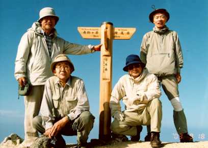
at the summit of Mt. Utsugi
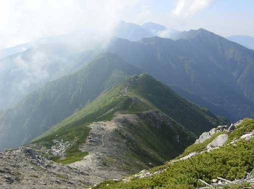
From the summit, they looked back the long way they had passed through yesterday.
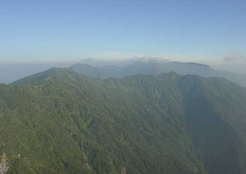
Looking back the mountain range which they have walked through
Under your eyes, you can see Ikeyama ridge which you have to walk down until it reaches ground level of 900m.
Looking down Ikeyama ridge from the summit
When you look back you can see gentle shape of Mt. Utsugi.
Looking back Mt. Utsugi from the Ikeyama ridge
They walked over 7 hours until they have arrived at the end of a car accessible road. They walked 30,000 steps in 2 days.
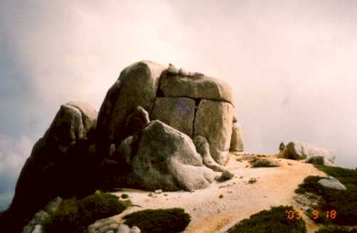
Komaishi Stone and Mr. Greenwood (photo by Mr. Kuribayashi)
Schedule and the Performance
| Date | Place | Scheduled Time of Arrival | Actual Time | Steps | Height Diff. | Steps/Hour |
| First Day | JR Odawara STN | 7:50 Departure | 7:50 | |||
| 9/16/2003 | Lake Yamanaka, Central Express Way, Komagane IC | |||||
| Sugenodai Parking (900m) | 12:00,12:40 Departure | 12:12 Departure | ||||
| Shirabi Daira | 13:00 | |||||
| Senjyoujiki STN (2,600m) | 14:00 | 13:15 | 0 |
0 |
0 |
|
| Hoken Hut | 15:00 | 14:25 | 1,245 |
250 |
1,245 |
|
| Mt. Hoken(2,850m) | ||||||
| Second Day | Hoken Hut | 6:00 Departure | 6:15 Departure |
|
0 | |
| 9/17/2003 | Senjyoujiki STN | 7:00 | 7:07 | 2,087 |
954 | |
| Gokurakudaira | 8:00 | 2,565 |
540 | |||
| Mt. Hinokio (2,727m), Lunch | 11:30 Departure | 12:00 | 6,747 |
1,045 | ||
| Mt. Ikezawa (2,778m) | 15:00 | |||||
| Kisodono Hut (2,587m) | 15:30 | 17:30 | 11,865 |
930 | ||
| Third Day | Kisodono Hut | 6:00 Departure | 6:00 Departure | 12,293 |
||
| 9/18/2003 | Mt. Utsugi(2,864m) | 8:00 | 8:10 | 12,814 |
0 |
240 |
| Lunch | 10:00 | |||||
| Shirinashi (1,970m) | 13:05 | 21,531 |
-894 |
1,772 | ||
| Ikeyama Drinking Spot | 13:45 | 23,868 |
|
3,504 | ||
| End of Ikeyama Road (1,400m) | 14:50 | 29,377 |
-1,465 |
5,101 | ||
| Sugenodai Parking (900m) | 15:00 | 15:20 | -1,964 |
|||
| JR Odawara STN | 20:00 |
September 21, 2003
Rev. Feburuary 1, 2006