Mr.& Mrs. Cooper visited Monument Valley in Arizona in May 2003. Here are some pictures and notes they have taken in that trip.
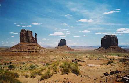
These are from Monument Valley which is a NAVAJO park, not part of the USA! The reservation is huge, spanning parts of 4 states and is operated by the Navajo Tribe. I hope my pictures give some impression of the grandeur of the place. Quite the most spectacular area of our trip. All the pictures here are from Arizona, quite close to Las Vegas, route #66, etc.
Monument Valley
I am waving in the first picture from a point which juts out high above the valley below called John Ford point after the famous director who loved to film here.
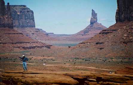
John Ford point
We were there is early spring (beginning of May), and as you can see, wild flowers were blooming.
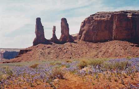
wild flowers were blooming
They have also visited a famous canyon named Canyon del Muerto, part of the Canyon de Chelly. This was named after a massacre of Indians by Mexican soldiers while they were occupying the area which is now Arizona and New Mexico. The canyon has been occupied since about 2500 BC. Navajos still live and farm in the canyon.
The next picture was on the Lukachukai pass in the Chuska Mountains on the Arizona / New Mexico border. As you can see, snow lingers here at about 3000m elevation. The white bark trees in the center are Aspens, which are spectacular in autumn.
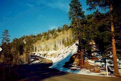
Lukachukai pass in the Chuska Mountains
Following is a unique volcanic remnant - called "Shiprock". This is in the NW corner of New Mexico, near the town of the same name. It is the hard core of an ancient volcano, left standing after the softer, surrounding mountain eroded away.
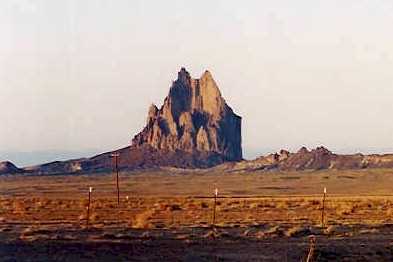
Shiprock
The last picture is from the misnamed "Aztec" ruins near Farmington, NM. The people who lived here from 900 to 700 years ago were ancient Pueblo people, unrelated to the Aztecs. The first discoverers chose "Aztec" and the name has stuck. The large Kiva was reconstructed in the 30's.
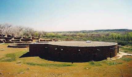
large Kiva
Following two pictures are taken in or near Santa Fe. First one is of the central Plaza and shows one of the oldest buildings in the Americas - the Palace of the Governors. As the guide put it "When Shakespeare died, the roof was already leaking"! I believe it was built in 1610. There are only two styles of architecture allowed in Santa Fe these days. This illustrates the famous "Adobe" style. If you look carefully, you can see many traders under the front porch. By law these can only be Indians, who were granted this right under the Spanish rule (I think). Non-Indian traders are allowed to trade in the central part of the plaza, you can see them in the foreground.
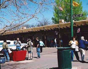
central Plaza of Santa Fe
Following is a building just to the right of the Palace. This illustrates the other acceptable style in Santa Fe - the "Federal" style. These are much less common and very few new ones are being built.
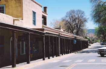
"Federal" style in Santa Fe
Next two pictures are from Taos, a historic town and also a ski resort, about 120 km north of Santa Fe. It's also just above 2,000 m elevation. The Spanish had reached Taos within 50 years of Columbus' first voyage. One Building in the central plaza dated from the 1540's. It contains the most famous of all the Pueblo Missions - that of San Francisco de Asis. (Basilica di San Francesco, Assisi) This was completed in 1816 and is one of the most photographed buildings in New Mexico. You may well have seen some of the pictures in another context. An overall view is shown in the next picture. Georgia O'Keeffe's favorite spot. Inclined mound protect over stress of the building structure.
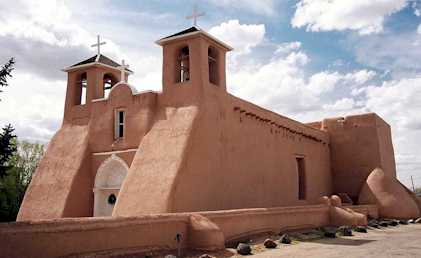
San Francisco de Asis
The next one is from the Taos Pueblo, which is unique in that the Pueblo Indians still live there. They have been in residence for over 1000 years. As you can see it is a spectacular site, with the Sangre de Cristo mountains close by and a beautiful stream running through the central open space.
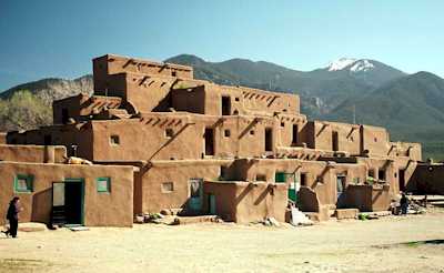
residence for Pueblo Indians
The last one is the Gorge of the Rio Grande River in northern New Mexico. It's very small here, near it's origin, but has cut a canyon almost 200 m deep. This is in desert country about 15 km from Taos. The Sangre de Cristo mountains are dimly visible in the background. The poor visibility is not smog - it's dust, blown by the very strong winds here that day.
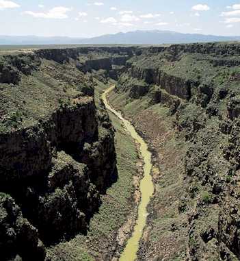
Gorge of the Rio Grande River
June 7, 2003
Rev. January 21, 2008