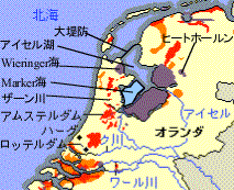
Polder and its time of reclamation
orange:1300-1600
red:1600-1900
purple:1900 to go
blue:suspended reclamation
As Netherland has many reclaimed land called Polder, therefore water management is crucial importance for this country. Following map modified by Mr. Greenwood shows current status of reclaimed land. After 700 years continuous effort of reclamation activity in Netherland, it was stopped about 20 years ago. Maker sea remained as water filled fresh water lake, with lake Ijsselmeer.
|
Polder and its time of reclamation orange:1300-1600 red:1600-1900 purple:1900 to go blue:suspended reclamation |
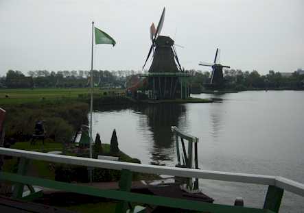
When Mr. Greenwood first visited Den Haag, he was very impressed to see a cargo ship is cruising over highway. Just south of Schipol airport, there is a place where a canal connecting lake Westeinder and lake Kager pass over highway.
The lake Ijsselmeer was created by building 30km dyke. Water flow into lake Ijsselmeer is controlled, and majority of water from the river Rhein flows to Rotterdam area.
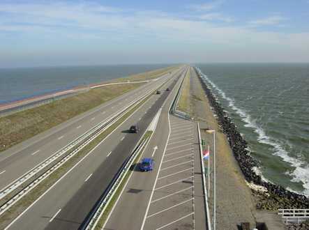
The dyke
Each polder has at least one pumping station called Gemaar and rain water is pumped up to ring canal surrounding the polder or to the river next to the polder. Those water is finally flows out from lake Ijsselmeer at low tide.
Water level of reclaimed land is lower than river Zaan
When Mr. Greenwood visited Giethoorn, he found a pumping station in a polder. He was very impressed when he found that power supply to the pump station and to all houses in country side are done by buried cables. Thanks to this, countryside looks very clean and neat.
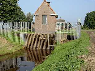
Gemaar (pumpong station) for a Polder near Giethoorn
2003/10/10