Major event of summer vacation in 1999, was tracking of Kawakami-Makioka mountain trail. The trail runs between Kawakami village located upstream of Japan's longest river Chikuma and Makioka town near Enzan city. The trail evidently not paved and runs at 2,300 meter above sea level. There is a chance of falling stones.
First Day (August 6, 1999)
Mr. Greenwood moved from home to lake Kawaguchi near Mt. Fuji in a strong rain fall.
Second Day
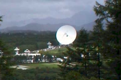
Mr. Greenwood started lake Kawaguchi toward Makioka town. But due to bad weather, he changed original schedule of attacking Kawakami-Makioka mountain trail from Makioka side. Instead, he went to Yatsugatake mountain range. Then, he visited Nobeyama radio observatory.
Nobeyama Radio Observatory
He took lunch at Yatsugatake Highland Lodge. He found Re-ex hotel. Then moved to Nagano city.
Third day
He took soba noodle at Ohokubo Nishino Chaya in Togakushi village. After visiting lake Nojiri, he took ice cake at Chikufudo in Obuse town.
Forth day
He started Nagano city and crossed Mugikusa pass of Yatsugatake mountain range. He stayed at Re-ex hotel.
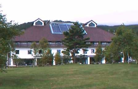
Re-ex Hotel
Fifth day
He started Re-ex hotel at 8 o'clock. He entered Kawakami village and started tracking of Kawakami-Makioka mountain trail from Nagano side.The trail is narrow and rough. It is partially paved but mostly rough road. There is a danger of falling rocks. You definitely need 4 wheeled drive car. The jeep run 837km in 5 days.
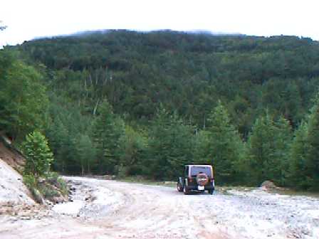
Kawakami-Makioka Mountain Trail
![]()