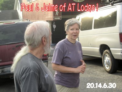
Introduction !It has been my dream that after finishing Pilgrimage in Spain, I would like to walk on Appalachian Trail (AT),in rich Amerikan wild forest and mountains with American People. Appalachian Trail was established in more than 100 years ago and has been maintained by many local good-spirit volunteers to protect its wilderness. Accordingly, places for camping are strictly disignated and restricted. It is also understood that we must carry all necessary items for life, like tent, sleeping bag, foods, cooking vessel, stove, fuel, so on in backpack. 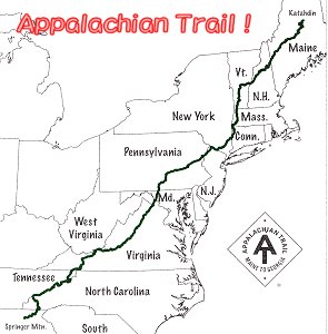
Appalachian Trail starts from Springer Mt.(1,153m) GA ,
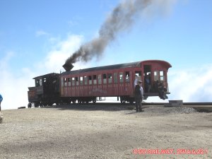
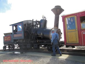
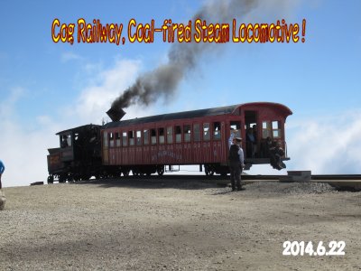
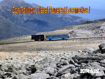
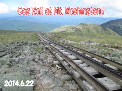
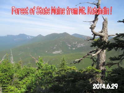
through 14 States, to Mt. Katahdin (1,605m) ME, is as because there are many mountains between 4,000 and 6,000 ft and beautiful sightseeing spots such as Mt. Washington and COG Rail. This section is as long as 240 km , only 7 % of eitire AT . I thought the route would not be so easy for a man of 72 years old because of very steep slopes of ascent/ descent with over 30 lb backpack everyday. If I could walk through without serious problems, then I will consider about next step in AT later.
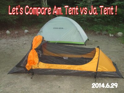
List of Backpack Contents:In order to limit total weight less than 15kg,: Backpack 60 liter(1.7kg),Tent(for one 1.5kg),Sleeping Bagüi0.5ćs) Those Helpful Literatures:
|
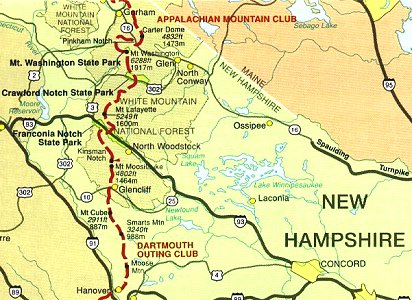
Departure !June 10 In twelve hours after taking off from Narita, Tokyo, I landed at Boston Logan Airport.Dartmouth Coach Bus took me to the town of Hanover, NH after three hours ride. This is a campus town of the famouse Dartmouth College, very good place for study. I checked in Sunset Motel just 2 miles from town. June 11 Visited firstly, DOC (Dartmouth Outing Club) Headquarter to obtain the latest information on AT trail conditions and other, if any. They kindly provided me with nice map from Hanover to Kinsman Notch . Then, visited stores to buy gas fuel for stove and foods of lunch and some sweets, etc.. Now, ready to start.
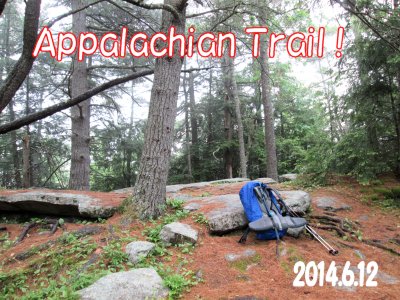
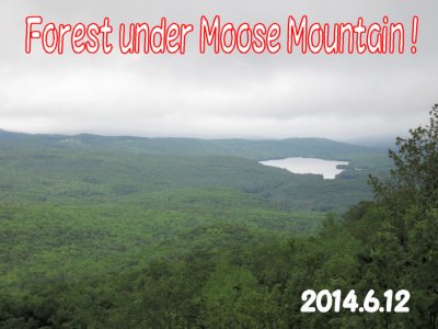
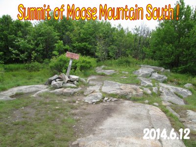
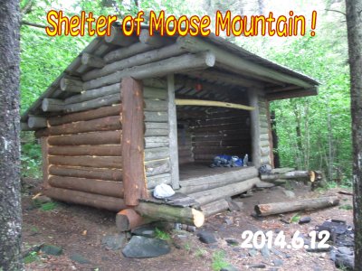
To Kinsman Notch ! (52.7miles =84.3ćqüjJune 12,(1st day) Raining day. At 8 o'clock ,I entered into Appalachian Trail from just beside of gas stationIn late morning, rain became weaker, and easier for me to walk. At 3 o'clock, arrived at Moosemountain Shelter . In the shelter, one young hiker had set his tent and listened radio. He said that he walked from North and is student of University of Maine . He already walked about 440 miles from Mt. Katahdine . I set my tent at other end of the shelter and changed wet underwear to dry one and started to cook. Some time later in evening, one Russian hiker arrived at shelter, but his sleeping bag was terribly wet and hard to sleep at this altitude of 2,130 ft, mooved to nextlower shelter. Today's Milageüü10.9 mileüi17.5ćqüj 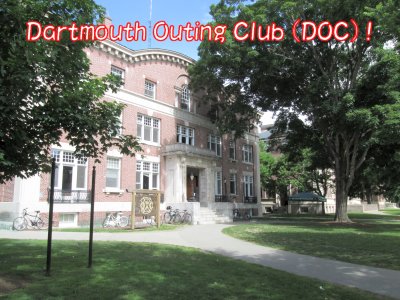 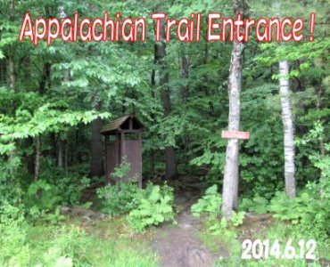
June 13üi2nd day) During night, strong wind and rain bothered me, but next morning weather slightly improved. Under light shower, started at 7 o'clock, kept walking toward to Smartmountain Shelter (3,237 ft). ü@From around noon , rain became heavier, and heavier. It was very miserable conditon for me, and rain reached to skin through raingere very wet even inside of shoes and hard to see front through glass. One point to cross autoway around noon time, there was a house with sign üuFree Icecream to Hikerüv,but no one was there unfortunately. On the top of Samrt- mountain , trail became very slippery and dangerous, and I slipped once to hit my nose to rock. Anyway, bad day was over at 5 o'clock after reaching the Cabin. (shelter was burnt down some years before). One party of two people was there. Due to old cabin, I used my tent again, and changed clothes quickly to cook my dinner. Today's milage=12.4 mileüi19.9ćqüj 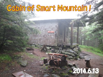 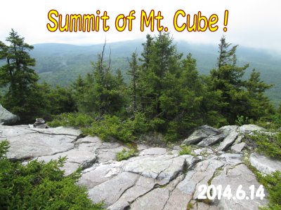
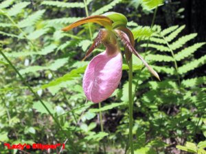
June 14.üi3rd dayüjüB In the morning, rain almost stopped.ü@But, wore half-wet underwear and rain gear again . Departed at 6:30 am. Around noon, rain completely stopped and sky became brighter, although visibility still poor. Once descended down to South Jacobs Brook (1,450ft) then ascended toMt.Cube (2911ft) and ate lunch at the summit. Trail led me down to road NH 25A , 915ft. Ore Hill Campsite, 1,883ft was not far here with slight uphill trail. There was a big Surprise at trailside, which was samll, pink-colored flower, Lady's Slipper just in full blossom, shouted How LuckyüI. When asked to hikers on trail, it was right timing to see this flower here. At 5 pm, arrived at Ole Hill Campsite , but nobody was there beside me. After dinner, made my foods hung down from branch for protection from bears. Today's milageüü12.8 mileüi20.5ćqüj ü@ 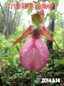 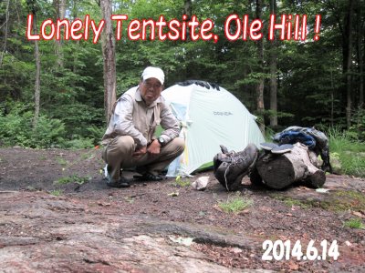
June 15thüi4th dayüjüB Started at 6:30 am, but the way back to Trail disappeared, and got lost.ü@Path was covered with leaves. Because of few people use this Campsite , path was easily lost. However, use compass and map carefully, then found the trail after 40 minutes wondering. At almost noon time, I arrived at the broad paved auto road, NH 25 . Took about 10 minutes walk to east, found a nice Hostel for Trail Hikers in a small town, Glencliff . The name wasHikers Welcome Hostel and received very warm and heartful hospitality. Taking shower, useed laundry machine and enjoyed conversation with young hikers. In the evening, we rode on owner's coach car to the market in Warren for shopping foods and drinks. Next day, let's Slackpack withsmall backpack over Mt. Moosilauke from Kinsman Notch to Glencliff. Even, giant Mt.Moosilauke would be not so difficult to me. Today's milage=7.3 mile(11.7ćqüj 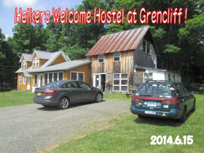 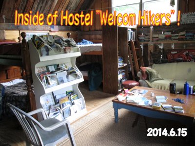
June 16thüi5th dayüjüB Beautuful weather!ü@Hostel owner provided me a ride to Kinsman Notch at 6 o'clock. Two hikers shared shuttle fee of $30. to save money. " How Nice !" From the parking of Kinsman Notch (870ft), I started to walk southbound along to Beaver Brook . As backpack contained only lunch, rain gear, water and spare clothes, it was such easy to walk with it. and I could proceed faster. At 9 o'clock, I reached the summit of Mt. Moosilaukeüi4,802ft). Just before reaching the summit, 4 hikers party appeared from South, who were staying in the same hostel preveous night. They were all carring over 40 lb backpack.ü@I had a lunch at the summit alone, then left for Glencliff without any problems. At the point very cloth to NH 25 Road, trail came to section point with two choice of direction. However, there was NO SIGN for hikers. This part of the trail was a temporary one , because of destruction by heavy rain a few years ago. I bet one of trail as right one, but was mistake which forced me one hour more walk. Finally, a kind local resident took me back to Hikers Welcome Hostel by his car at 1:30 pm. Today's milage=8.4 mileüi13.5ćqüj. Extra walk was not counted. 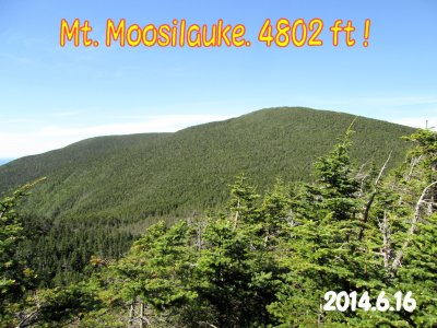 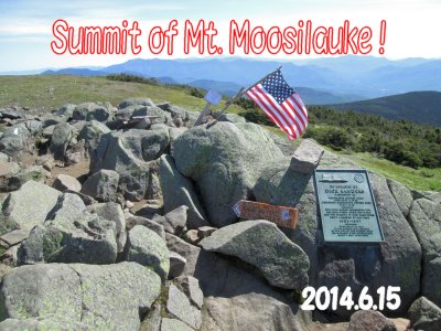
|
|
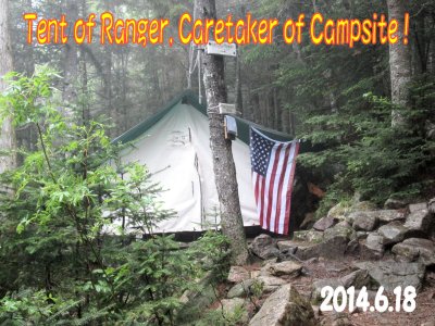
From Kinsman Notch to Crawford Notch (44 mileüü70.5ćq.)June 17thüi6th dayüjüBü@At 6 o'clock, owner of Hikers Welcome Hostel carried me to Kinsman Notch (1,870ft)Five-days foods obtained in Warren increased total weight of my backpack to 40 lbüiüü18ćsüj, but my shoulder increased strength also in last 5 days. Accordingly, it was not so tough to me to climb continuously from Kinsman Notch (1,870 ft) up to Mt. Wolf (3,478 ft) in morning. From Mt.Wolf (3,478ft) , trail became downhill to Eliza Brook (2,408 ft) . Second acsending from Eliza Brook to South Kinsman Mountain (4,358 ft) was extremely tough and demanding to me. Over two hours struggle, reached the summit and next small peak, North Kinsman was not a problem. Kinsman Pond Shelter (3,763 ft) was just there. At before 7:00 pm.,, I checked in at Ranger's Tent Office and paid Fee of $8.00 per person in White Mountain Nat'l Forest .ü@One trouble of this day was that I felt lost from Apparachian Trail , because I could not see any White Marks on trees between Mt. Wolf and Eliza Brook . I put my backpack at Trail-side and searched any marks or footprints there to confirm the trail is correct or not. Suddenly, a young hiker, Trail Name of "Hatch" from Indiana whom I met at Glencliff , passed me with his comment: " This must be correct ". I could not meet him again for a while, but 8 days later I could see him at another Hostel in Gorham. Today's milageüü11.5 mileüi18.4ćqüj 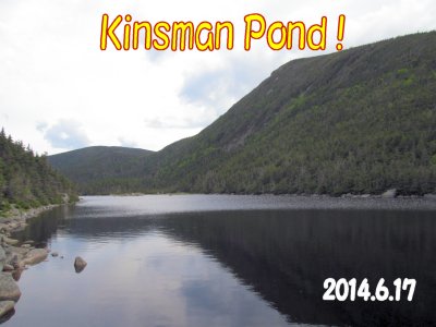 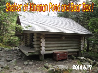
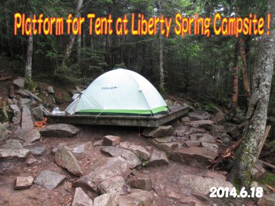
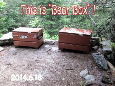
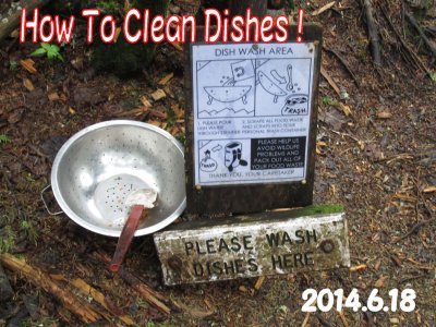
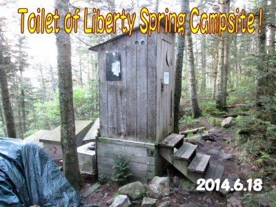
June 18thüi7th dayüjüBü@In the previous night, total six hikers arrived after 8:00 pm.. Shelter was quite busy. This morning, heavy fog covered the trail ahead. I decended to Franconia Notch (1,443ft) and crossed Interstate 93 through under bridge path. Then, we had to crimb the long, steep slope to Liberty Spring (3,910ft) . Milage of today was not so long, but tough due to the big descent and ascent to pass the Franconia Notch . At about 11 o'clock, I arrived at the entrance of Liberety Spring Trail . It took two and half hours to reach Liberty Spring Campsite . This was the place for today's Campsite. It was still early in the afternoon, but so nice to enjoy and relax here. Up to here, I used filtered water by Sawyer Filter System for safety to health. Now, here was absolutely pure, clean spring water. How delicious and cold to drink directly ! Wish I got some Whisky with this pure water ! However, no alcohol in my back-pack at all. From Kinsman Notch , I entered into White Mountains Nat'l Forest , I had to pay a fee of $8.00 per person for camping but it was so good to use Bear Box and Toilet . Design of the toilet was so unique, I took some pictures. Today's milageüü7.5 mileüi12.0ćqüj 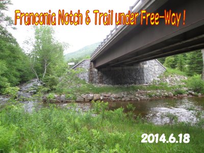 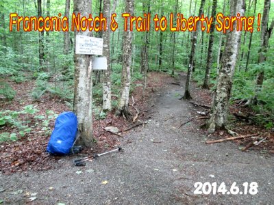
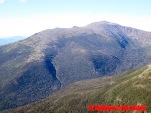
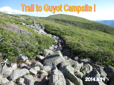
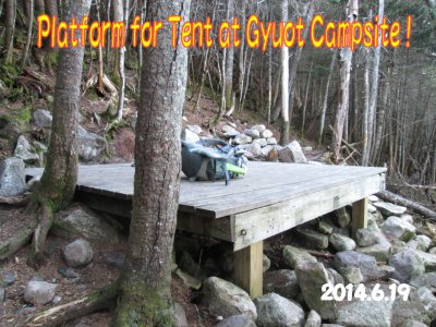
June 19thüi8th dayüjüB ü@Strong wind but clear sky. Took off at 6:15 am. Soon came to ridge without trees. Mt.Lincoln (5,089ft) was there. No trees meant there was always a danger from strong wind. Carefully walked and came to Mt.Lafayette (5,291ft) , which was the highest in this region. Very impressive to see its summit. Although these mountains were named with past Presidents, but no Name Plate on each Summit. Therefore, pictures shows only Trail names . In afternoon, weather became fine and comfortable. After descent some height, Mt. Garfield (4,500ft) was another tough ascending, then to Galehead Hut at 3:00 pm.. Today's campsite was still far, so ate some cockies and chese, walked to Soutu Twin Mountain (4,902ft) At 6:30 pm., Guyot Shelter, (4534ft) was waiting for me. I was terriblly tired and exhausted, but had to work for camping. Today's milageüü13.1 mile (21.0ćqüj 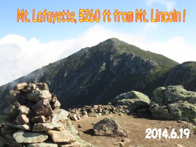 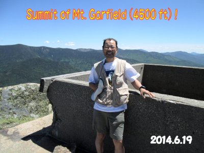
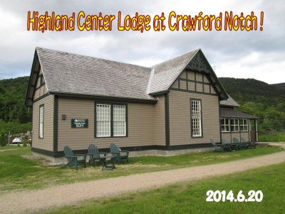
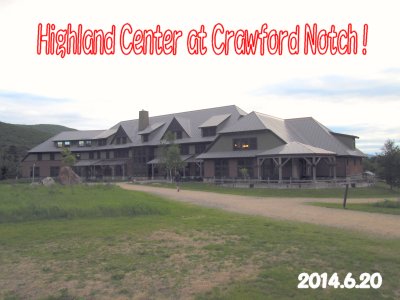
June 20thüi9th dayüjüBü@ As Campsite was deep in forest, very quiet in the night. When came to Zealand Mountain (4,260ftüj, very strong wind was blowing. I thought better short-cut trail by selecting Zeacliff Trai instead of Trail to Zealand Falls Hut. As name said,this trail was rough and steep, just as Cliff . This day was unforgettable, because I lost my camera somewhere in Zeacliff Trail . When I realized that I dropped my camera, I immediately got back the Trail and searched it carefully. 15 minutes later, I found my camera in the grass of trail-side where I used camera some time ago. I did not bring second camea with me this time, so it would be horrible, if I could not find it here. In the afternoon, on Ethan Pond Trail I found group of wild flowere, Lady's Sliper It was so nice to take a pictures of such floweres. From Ethan Pond Campsite (2,874ft) ,I walked down to Crawford Notch (1,277ftüj. At 3 o'click, I was picked up by Angel's car to Highland Center ,three miles away from trail-headüB Alhough I had not reservation in advance, Thru-Hiker was accepted in Bunkroom with $80:00 including dinner at cafeteria. This lodge was belonging to AMC (Apparachian Mountain Club) , then I could make reservation of Madison Spring Hut , which was scheduled to stay at two days later. Madison Spring Hut (4,800ft) was so expensive, priced as $135 per night. This day, the dinner was luxury including local beer. Today's milageüü11.9 mileüi19.0ćqüj  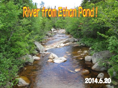
|
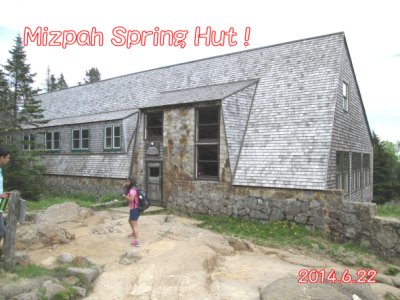
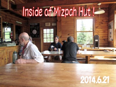
From Crawford Notch To Gorham (47.1 mileüü75.4ćq)June 21stüi10th dayüjüBü@I wished to start earlier, but first shuttle bus to Trail Head was on 8:30 am. From Trail Headüi1277ftüj to Webster Cliff Trail took me up to Mt.Webster, next to 3,910 ft Point , then to Mt.Jackson. . It was 12:50 pm, lunch time at its summit.ü@This trail was quite thrilling because trail was built along to top of cliff. So, we saw directly the bottom of cliff, about 1,000 m below. There were many family hikers, mostly of one day hiker and seemed to be happy time to them. At the end of Cliff-Trail, horizontal trail continued to Mt. Washington, but in thick cloud. At 2:40 pm., arrived at Mizpah Hut and Nauman Campsite was just next to the Hut. Being a popular hiking spot in New Hampshire , many hikers with their tents already registered in. In this campsite, each platform was occupied with 3 to 4 tents, and very much crowded. In late afternoon, I visited Hut to get water for cooking and took a look at inside of Hut. Today's milageüü6.4 mileüi10.3ćqüj 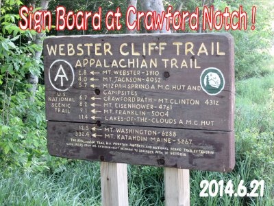 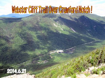
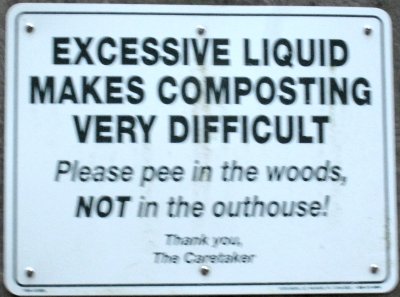
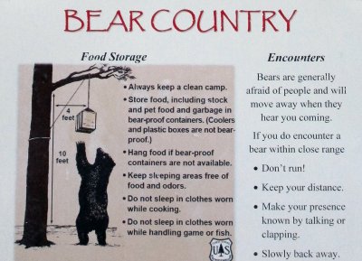
WarningüI . On Appalachian Trail, there were interesting Sign Board
and Warning . Followings are some examples:
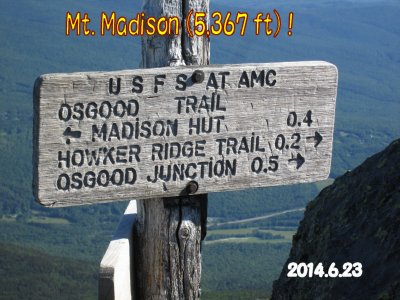
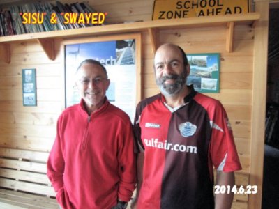
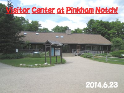
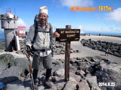
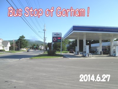
June 22nd (11th dayüjüB Waked up at 3:30 am, because it was anticipated to be Long, Tough Day. morning walk near Hut. Weather was perfectly fine, no wind and no cloud.ü@Leaving Hut at 7:40 am., ascent of700ftwas a good job to peak summit of Mt.Madison (5,366ft) . Behind of me, Mt. Washington was such far. It reminded me hard walk of the preveous day. Bonnie and Ken were fine in morning, but looked to be still tired. They would return to home today, but my hiking would continue to Town of Gorham, NH in another two days. From Mt.Madison (5,366ft) , trail started to descend sharply by almost 5,000 ft to Osgood Tentsite in 3 hours. Heavy backpack was not gentle to my shoulder on downhill trail. From Osgood Tentsite , trail became flat and smooth. At about 2:00 pm., arrived at Pinkham Notchüi2ż050ft) and Visitor Center. Shortly, two familiar Thru-Hikers , üuSISUüvandüuSUWAYEDüv, both trail name, walked same time from Glencliff . We called White Mountain Logde & Hostel to ask for stay and requested pick-up shuttle to the Notch . 30 minutes later, we were in Black Audi to town of Gorham . Very fortunately, we got beds there at $35.00 per night including shuttle, breakfast and laoundry service. Later, we knew that Hostel Owner , Marni prepared us such nice, good in taste and volume breakfast in following days. Good Hostel ! Today's milageüü7.8 mile(=12.5ćqüj 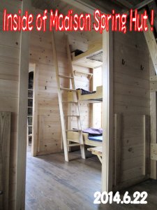 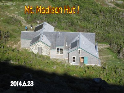
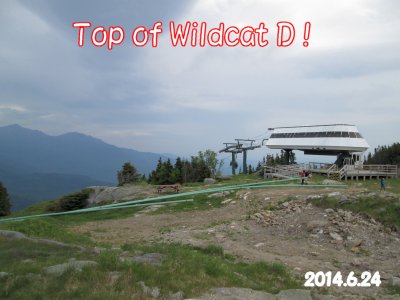
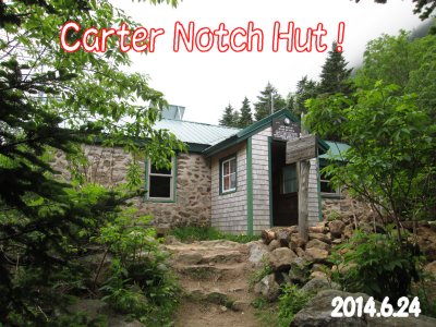
June 24thüi13th dayüj ü@Last night, I made up very light packing for only one night camping. weighing less 10 kg from normal. It was SLACKPACK again from Pinkham Notch to Exit of Trail at Driveway US2 of 21 mile (=33.7km) . Shuttle Audi left Lodge at 8:00 am., but lost some time for Post Office opening time delay. Anyway, started Notch at 9:00 am., I walked in good speed, to Wildcat Mountain without break. because of light backpack, I reached to 4,000ft point at 11:20. Then, Carter Notch Hut at 1:45 pm.. Had a lunch here, but it started to rain that I was afraid of. Passed Carter Domeüi4,832ftüj at 3:00 pm., then arrived at Middle Carter Mt. (4,610ft) at 5:30 pm.. It took a time more than my thought, but finally reached Imp Campsite (3,344ftüj after 6:45 pm.. Here, Ranger (or Caretaker ) waited me to collect $8.00 for usage of shelter. There were some hikers of SOBO , and lower floor was ful already, and slept on upper floor. It was so good to stay in Shelter on such raining day. Today's milageüü13.1 mileüi=21.0ćqüj 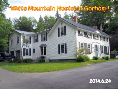 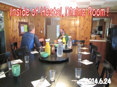
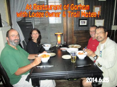
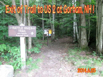
June 25thüi14th dayüjüB Today was the last day to me on Apparachian Trail 2014. It was Finishing Day of Hiking Rain stopped in morning, and started at 7:00 pm to North from Shelter . Other hikers went to South. On wet wood trail, it was slippery sometime and must be cautious . Mt.Moriah(4,049ft) was not far from the shelter. Departing from ridge, trail extended along to Rattle River, altitude was lost quickly. When flowing water seen in Brook, a lot of mosquito appeared and bothered me terribly. At 12:30 pm., I came to the end of trail where Driveway US2 side. Form here, only 150 yards to west, I found White Mountains Lodge & Hostel which I stayed two days ago. Those familiar faces were there and said to me "Good Walk and earlier Arrival". In those faces, I found "Hatch of Indiana" whom I lost at Eliza Brook . As I liked this hostel so much, decided to to stay following two nights. After 1:00 pm., rain started and becoming worse and worse. How Lucky I was ! Today's Beer was so nice and tasted not bitter. Today's milageüü8.0 mileüi=12.8ćqüjüB 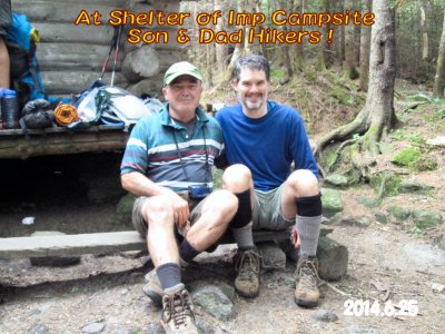 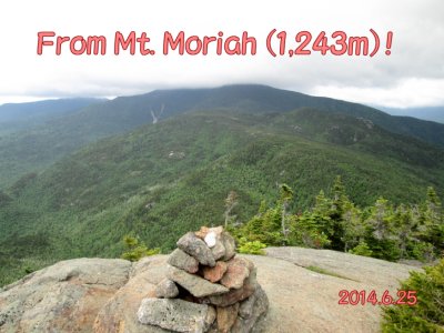
June 26th (15th day)ü@In the morning, hikers in Hostel started to North, one by one, including "Hatch of Indiana" . I was on Day-Off, zero day. I asked landaury and wrote Post Cards to my family and friends. World Cup of Soccer was on TV. But I needed to study about Mt.Katahdin and way to Millinocket, Maine. In afternoon, I took a short walk to trail head of Cenntenial Trail and enjoyed scenery of Androscoggin River. Goal of AT was still 298 miles (=477ćqüjaway !. I do know if I could walk the remaining Appalachian Trail again in future, but I would think about it in Japan.  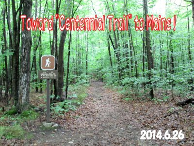
|
Part 2 Mt. Katahdin Hiking Record ! |
Goal of AT Trail to Summit of Mt. Katahdin !
June 27,(16th day) At 7:00 am., shuttle coach took me to bus stop for Concord Busline .
Concord Bus Accordingto the latest information on Mt.Katahdin, Abor Trail was closed in this season because of destruction of trail by avalanche. Another campsite near üAMt.Katahdin was Katahdin Stream Campgroundwas fully booked at this moment. Fortunately, Rory obtained his reservation for the campsite, I asked him to share reservation with me to pay half (=$15.00) and he accepted my proposal. Modified plan was that starting Lodge in the morning of 29th and to climb Mt.Katahdin , then after descent from the mountain we will stay the campsite in each tent. On 30th, I would return to Lodge in Millinocket , but Rory would go to his SOBO hiking into 100 Miles Wilderness . Accordingly, 28th was the day for last preparation for last activity and shopping foods, relaxing in the Lodge . For information, I note here the payments to Lodge as follows: SOBO Package is $70.00 for pick-up shuttle at Medway, bed in bunkroom, and shuttle fee to Kathadin Stream Campsite . I paid more because for additional bed fees and shuttle fees. 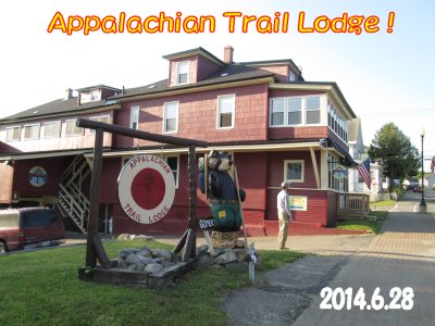 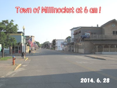
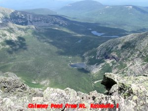
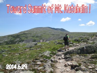
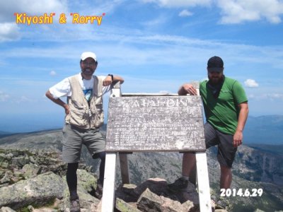
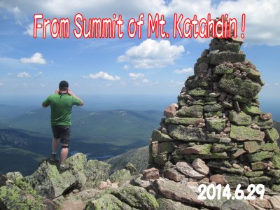
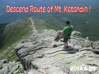
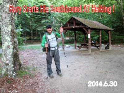
June 29,(18th day) There was one Cafe in downtown Millinocket , which open at 5:30 am.. Taking breakfast with Rory , we departed for Mt.Katahdin with other two young hikers staying in the Lodge. At Ranger's Office, we left our big back-packs there and changed to small one-day hiking pack with lunch, water, camera, rainwear, ECT.. Being Sunday and fine weather, it was a quite busy day for Mt Kathadin , we met many young oneday hikers. I remembered Mt. Washington , but there was a difference here for such flat area with independent big Mountain. In about 2 hours, we came to the height over Tree-Line . There were more big rocks and thrilling trail here but no fear of danger. This was a Table-Shape mountsin and remained long walking trail after reaching its Shoulder, such as 2 miles. Since Rory was the first day on Appalachian Trai Hiking , he had to stop often due to foot cramp. We took many short breaks for drinking water. Finally, Rory and I arrived at the Summit at 12:30 pm., and enjoyed 360 degree wide view. Because of time limit, we left the summit in a half hour, started last walk down to the Campsite. At 4:45 pm., we came to the Ranger's Office and filled Register Form there. In the evening, we talked many things, his plan from here to Springer Mt. GA of 2,200 mileüi=3,500ćqüj in next 6 months and my experience of only two weeks. Anyway, it was the greatest day to both of us having put our footprints on Mt.Katahdin . Today's milageüü10.2 mileüi=16.3ćqüj 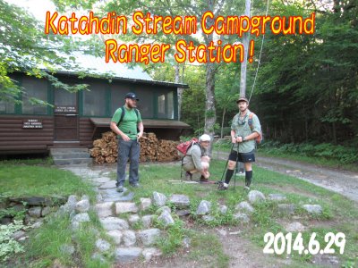 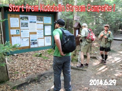
June 30,(19th day) Early in the morning of 6 am, Rory disappeared in the direction of
100 Miles Wilderness
July1,(20th day)Around 9 am, shuttle coach of Appalachian Trail Lodge
left for the Bus Stop of Medway,
|

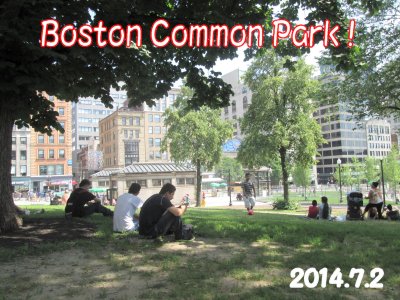
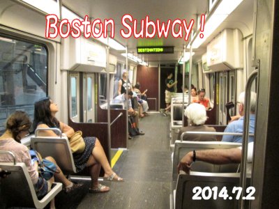
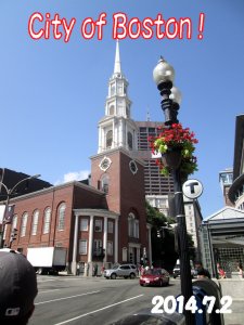
BostonJuly 2,(21st day) It has benn well known that Museum Fine Art Boston had owned high quality arts fromall over the World. So, it has been my wish to visit there someday. Particularly, a famouse Japanese painter of Edo period (16 to 19 century), üuShohaku Sogaüv drew huge Dragon and Clouds in black/white as pictures for doors of temple. It was a surprise to me that this Dragon and Clouds has been exibited regularly after long time reparing works. Beside that, there were many other Japanese artistic works and budda sculptures opened to visitore. I was so happy to see them with a discounted admission of $22.00 for seniors. Next day, I flew from Boston Logan Airpot to Japan.
URL of Lodge/ HostelDiscussion after Hiking.
|

Part 3 ! Photo Gallery ! |