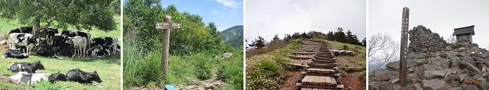
ü@I like the feeling of achievement when reaching to the contact with nature, a forest bath, and a summit, and arriving at them, and I sometimes walks in the mountain.
Climbing
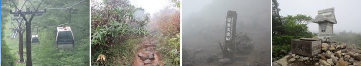
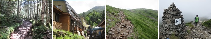
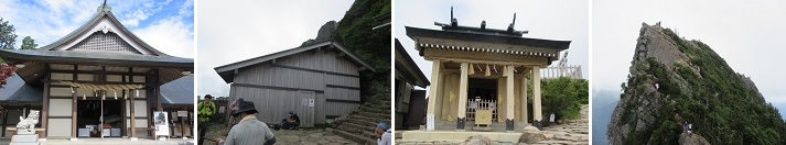
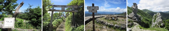
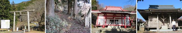
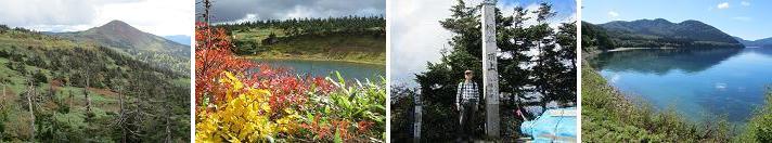
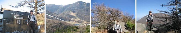
ü@*Azumayasan (2354m): Azumayasan is the latest mountain in the Ueda region of Shinshu to retain snow, and atop it lies a sacred shrine said to have been erected by Sanada Masayuki. The Sugadaira Plateau at the southwestern foot of the mountain is famous for skiing in winter and sports training camps in summer. Take the Hokuriku Shinkansen from Ueda Station to the Jodo Bus bound for Sugadaira and get off at Sugadaira Kogen Davos. It's a one-hour walk from Sugadaira Kogen Davosor to the Sugadaira Ranch trailhead. From there, ascend via small and medium gazebos to the summit of Azumayasan in three hours and 15 minutes. From the long, narrow summit stretching east to west, a magnificent panoramic view unfolds, encompassing the Northern Alps, including Mount Kusatsu-Shirane and Mount Asama. To descend, I took the same route from the summit back to Sugadaira Ranch trailhead, taking 2 hour and 30 minutes. (2025year 4th of August)
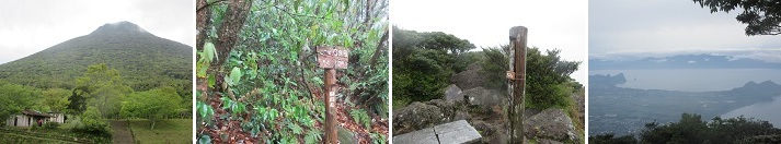
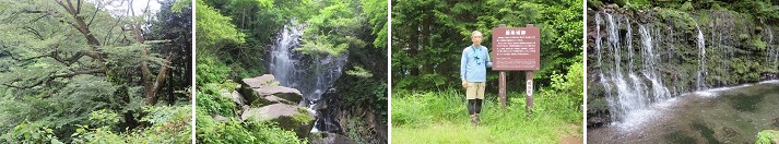
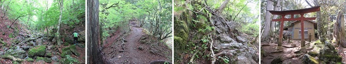
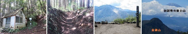
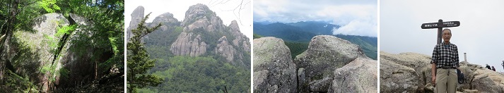
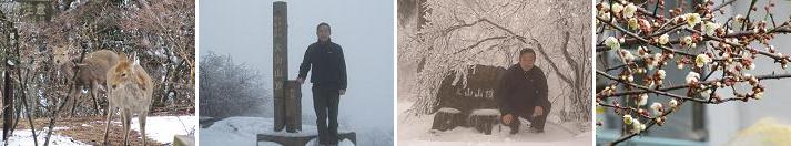
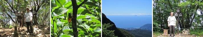
ü@*Kaimondake (924m): Kaimondake is a volcano located at the southern tip of the Satsuma Peninsula in Kagoshima Prefecture. A lava dome was ejected at the summit, resulting in the current two-tiered mountain shape. The mountain is primarily composed of low-viscosity basalt, but the lava dome near the summit is made of andesite. A spiral hiking trail has been established, allowing for a climb in about three hours. Although at 924 m it is relatively low among Japan's 100 famous mountains, the climb starts from around 80 m above sea level, resulting in an elevation difference of over 840 m. As an independent peak, the rocks become exposed as one approaches the summit, providing a 360-degree view from the top, with Lake Ikeda to the north and the Pacific Ocean to the south. After descending, I refreshed myself by washing off my sweat at the Kokoro-no-Yu in Ibusuki Onsen. (2025year 20th of April)
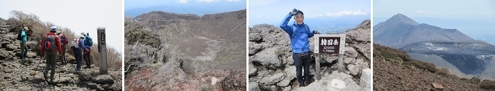
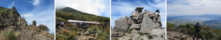
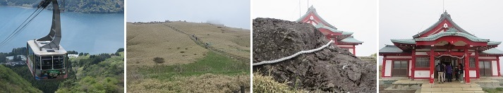
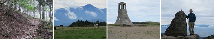
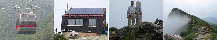
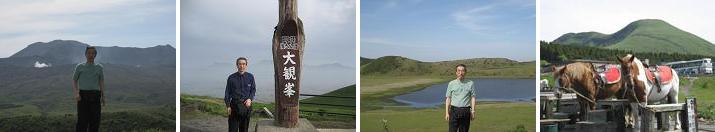
ü@*Mt.Karakuni (1700m): Mt.Karakuni is the highest peak of the Kirishima mountain range, a group of volcanoes that extends near the border of Miyazaki and Kagoshima prefectures in southern Kyushu, and is an active volcano that has repeatedly erupted since the beginning of history. From Ebino Plateau, where there is plenty of parking and visitor centers, walk a clockwise route with Mt.Karakuni crater on the left to reach the summit of Mt. Hank. From the top of the mountain, we could see the Onami Pond of the crater lake, Shin-en-dake, Naka-dake, and Takachiho peaks in the same Kirishima mountain range. Kirishima dogwood, Nokaido, and Miyama Kirishima grow on the Ebino Plateau at the foot of the mountain, and Nokaido. In 1996 , Kagoshima Prefecture set up the "Karakuni Refuge Hut" as part of the natural park development project, which was located between the summit of the mountain and Onami Pond. (2025year 19th of April)
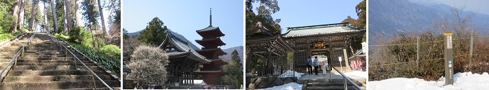
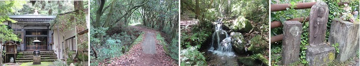
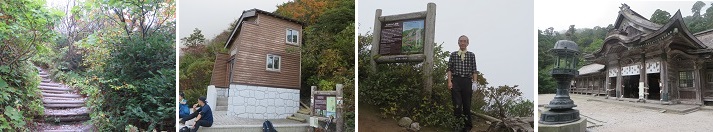
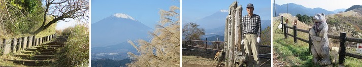
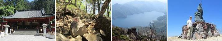
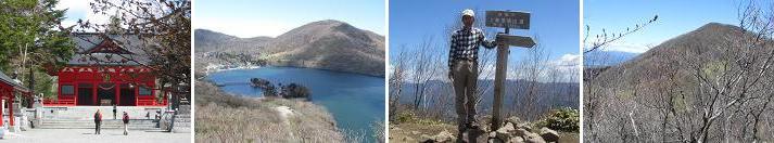
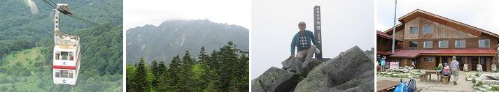
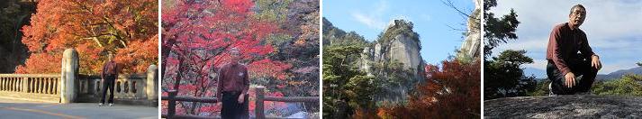
ü@*Mt. Minobu(1,153meters):At an elevation of about 400 meters on the foothills of Mt. Minobu, there is Kuon-ji Temple, the head temple of the Nichiren sect, and at the summit, there is the Okuno-in Shikin-kaku, said to be established by Nichiren in memory of his parents. Besides visitors to Mt. Minobu, many tourists also come for the great views from the summit. You can reach the top in about 10 minutes by ropeway from near the Kuon-ji temple grounds. At the summit, there is the Okuno-in and three observation platforms, where Mount Fuji is clearly visible from the east and south platforms, and on clear days, you can also see Suruga Bay and the Izu Peninsula. The descent is via the eastern route, which has many temples and halls on the east side, offering a more tourist-like atmosphere. There are numerous resting spots along the way, making it ideal for a leisurely climb. At the beginning of the eastern route, there is a building called Jorokudo, where a statue of Shakyamuni and others are enshrined. (2025year 23th of March)
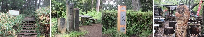
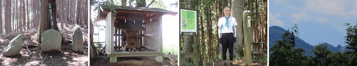
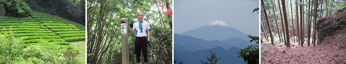
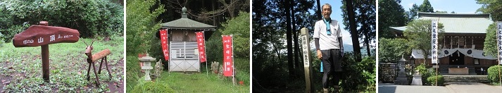
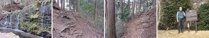
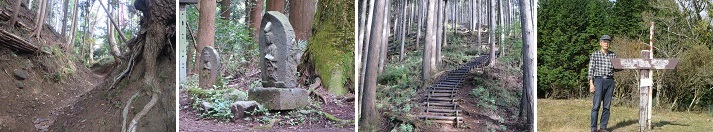
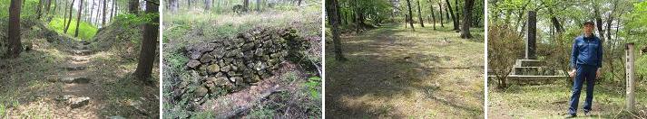
ü@*Mt. Kagenobu(727meters):Mt. Kagenobu is a mountain located between Mt. Kobutsujo and Mt. Jinma. I climbed the course with the shortest approach (walking distance 2.1 km, walking time 1 hour 15 minutes). I take the Keio Bus for 20 minutes from the north exit of Takao Station and get off at the last stop, Kobutsu Bus Stop. From there, a 15-minute walk to Mt. Arrive at Mt. Kagenobu trailhead. It took 1 hour to climb to the summit of Mt. Kagenobu. There is a vast open space at the top of the mountain, and after taking a commemorative photo, I ate the "rice balls" I brought with me in the square and enjoyed the view around me. On the way back, I was planning to walk to the Little Buddha Pass and get off at the entrance of the Little Buddha Pass, but the Little Buddha Pass was closed due to the outbreak of giant hornets, so I returned to the Little Buddha bus stop by piston. (2024year 7th of October)
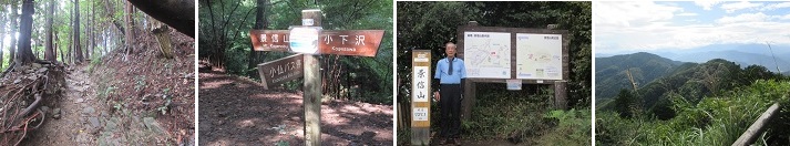
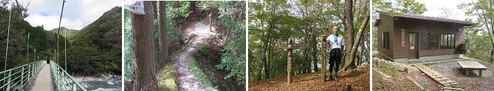
ü@*Mt. Kobutsujo(670meters):I climbed the nearby Mt. Takao and Mt. Kobutsujo. After stopping at Yakuo-in on Route 1 using the cable car, I arrived at the summit of Mt. Takao without any tough slopes. At the top of the mountain, I ate the "rice balls" I brought with me and enjoyed the view around me. I still had enough energy, so I decided to take another hour from Mt. Takao to Mt. Kobutsujo. Mt. Kobutsujo is a mountain located next to Mt. Takao. The lawn and teahouse at the top are perfect for a quick break. In addition, from the top of the mountain, you can see Mt. Takao, and Mt. Fuji, a World Heritage Site, at the same time. On the way back, use the No. 4 course, where there is a famous suspension bridge on the way and you can enjoy the feeling of walking, and take the Echo Lift back to Mt. Takao entrance. (2024year 23th of September)
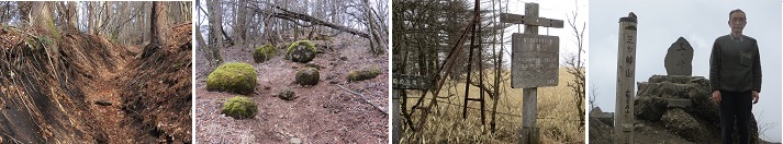
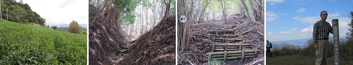
ü@*Kayagatake(1,704meters):I take the Yamanashikyo Kita Kotsu bus from JR Chuo Line Nirasaki Station for 25 minutes and get off at the Fukada Memorial Park bus stop. I walk in the following order: Fukada Memorial Park üĘ Onnazawa üĘ Onnaiwa üĘ Kayagatake Peak üĘ Fukada Memorial Park in 4 hours and 50 minutes. In March 1971, novelist Fukada Kyuya, known for his work on the 100 Famous Mountains of Japan, died of a stroke while climbing Kayagatake. At the foot of the mountain is Fukada Memorial Park, where the Fukada Festival is held every April by Nirasaki City and a local mountaineering club. At Fukada Kyuya Park, built at the trailhead, there is a monument engraved with the words "There are a hundred joys at a hundred summits" in his own handwriting, encouraging climbers who aim to reach the peak. From the summit of Mt. Kayagatake, one would expect to be able to see Mt. Kanagatake, Mt. Kinpu, Mt. Mizugaki, Mt. Yatsugatake, Mt. Fuji, and other mountains in Okuchichibu, but there were a lot of clouds and the trees on the summit had grown, so all we could see was Mt. Kanagatake. (2024year 8th of September)
ü@*Mt. Ibuki(1,377meters):I take the Meihan Kintetsu bus from Ogaki Station bus stop, take the Ibukiyama Driveway and ride for 1 hour and 25 minutes to the Ibukiyama Driveway Peak Parking Lot. I walk the Ibukiyama circular course in the following order: Sky Terrace - Ibukiyama West Trailhead - (West Trail) - Ibukiyama Peak - (East Trail) - Ibukiyama Driveway Peak Parking Lot. It takes 1 and harf hour to walk around Ibukiyama. Ibukiyama is the border between Shiga and Gifu prefectures, and from the peak you can see a panoramic view of Lake Biwa, Hira and Hiei mountains, the Japanese Alps, and Ise Bay. The trail collapsed due to a typhoon in July 2023, and there is a risk of falling rocks, so it is currently prohibited to enter the mountain from the base, and it is not possible to climb from the base. However, it was possible to drive to the end of the Ibukiyama Driveway (the parking lot at the 9th station) and climb from there to the peak (West Trail, Central Trail, East Trail). (2024year 22th of August)
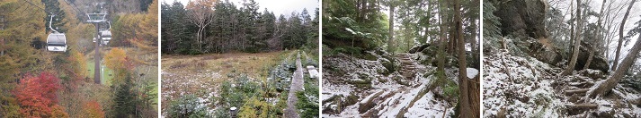
ü@*Mt. Oodaigahara(1,695meters):I take the Fukushima Kotsu bus for 45 minutes from Nihonmatsu Station on the JR Tohoku Main Line and get off at Okudake Tozanguchi bus stop. I take the gondola lift from the foot of the mountain station to the summit station and enjoy an aerial tour up to an altitude of 1300 meters. It takes 4 hours to walk in the following order: Yakushidake Observation Deck, Sennyadaira Junction, Adatara Mountain, Ushi no Back, Tsuji of the Peak, Kurogane Hut, Seishidaira Junction, and Mt. Okudake. Adatara Mountain is also mentioned in Chiekosho and Manyoshu, and is familiar to many people. The summit is gentle, but a small rock peak juts out, and its shape is the origin of its other name, Nipple Mountain. From the summit, you can see famous peaks to the north, south, east, and west, such as Mt. Bandai, the Iide Mountain Range, and the Zao Mountain Range. (2024year 31th of July)
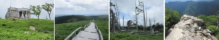
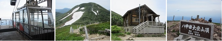
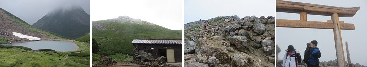
ü@üÜMt. Hakkoda(1,585meters):After staying the night before in Aomori, I take a JR bus from Aomori Station for 1 hour and 10 minutes and get off at the Hakkoda Ropeway bus stop. I take the ropeway from Sanroku Station to Sancho Koen Station and take an aerial tour to an altitude of 1,300m. I walk in the following order: Sancho Koen Station - Mt. Tamoyachi - Mt. Akakura - Mt. Ido - Shelter hut - Mt. Hakkoda - Sukayu Onsen. It takes 5 hours to walk from Mt. Tamoyachi to Mt. Akakura, Mt. Ido, and Mt. Hakkoda, making for a pleasant ridge walk. I relax from my mountain trip in a hiba bath. Mt. Hakkoda, the representative mountain of Aomori Prefecture, is a group of volcanoes that are attractive for their vast high-altitude marshes and the panoramic view from the summit. (2024year 22th of June)
ü@*Adatara Mountain(1,700meters):I take the Fukushima Kotsu bus for 45 minutes from Nihonmatsu Station on the JR Tohoku Main Line and get off at Okudake Tozanguchi bus stop. I take the gondola lift from the foot of the mountain station to the summit station and enjoy an aerial tour up to an altitude of 1300 meters. It takes 4 hours and 40 minutes to walk in the following order: Yakushidake Observation Deck, Sennyadaira Junction, Adatara Mountain, Ushi no Se, Adatara Mountain, Sennyadaira Junction, Yakushidake, Goryo Matsudaira, and Okudake. Originally, I had planned to walk clockwise from Ushi no Se, to Mine no Tsuji, but as we proceeded from the summit of Mt. Adatara to Ushi no Se, I wes hit by strong winds and were unable to move forward. I lay low under the cairn for a while, but the strong winds didn't subside. Approximately 15 leaders from the summit of the mountain who accompanied us for corporate training were determined to be unable to continue forward due to the strong winds, so we made our way back to Mt. Yakushi and took a rest at the gondola lift summit station, risking our lives. Adatarasan is written about in Chiekosho and Manyoshu, and is familiar to many people. (2024year 21th of May)
ü@*Ishizareyama(578meters):Take a private car to the Sagamiko East Interchange on the Chuo Expressway, turn left towards Sagami on National Route 20, turn left at the intersection in front of Sagamiko Station toward Atsugi on National Route 412, turn right towards Makino on Prefectural Route 517, turn straight for Prefectural Road No. 518 towards Atsugi and get off at shinohara-no-sato parking lot on the right about 500m ahead. The trailhead of Ishizareyama is located in shinohara village after going on the prefectural road for about 350m and entering the side road according to the information board of the Tokai Nature Trail.Ishizareyama is a mountain located in the northern part of Kanagawa prefecture and in the southern part of Lake Sagami. April is the time when this mountain is the busiest of climbers. The mountaintop surrounded by deciduous trees is quiet, with tables and information boards on the Tokai Nature Trail. The larvae of the Japanese luehdorfia feed on wild gingers. It is said that the only place where Japanese luehdorfia grows in the Kanto region because there is a wild gingers in Ishizareyama. (2022year 7th of April,2023year 9th of April,2024year 30th of March)
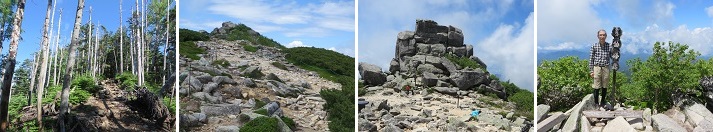
ü@*Mt. Iodake(2,760meters):By private car from the Suwa Minami Interchange on the Chuo Expressway, go through the Yatsugatake Echoline, turn right at the Karasawa Kosen/Sakuradaira junction, and arrive at the Sakuradaira parking lot in 1 hour. Change into climbing shoes at the parking lot, and take 5 hours and 22 minutes in the following order: Sakuradaira trailhead - Natsuzawa mineral spring - Oren hut - Natsuzawa pass/Yamabikoso - Mt. Iodake - Akaiwa no kashira - Oren hut - Natsuzawa mineral spring - Sakuradaira trailhead. walk. Iodake is a mountain in Minami Yatsugatake, and it is recommended as an introductory mountain to Yatsugatake, as it has the lowest degree of difficulty among Yatsugatake. From the summit, you can see the powerful explosion crater and Akadake, the highest peak of Yatsugatake, from a close distance. Many alpine plants such as Dicentra can also be seen. (2023year 18th of August)
ü@*Mt. Ishizuchi(1,982meters):From Iyo-Saijo Station on the JR Yosan Line, I take the Setouchi bus bound for Nishinogawa for 1 hour and get off at the Ishizuchi Ropeway-mae bus stop. From Shitaya Station at the foot of the mountain to Seiju Station at the summit, take a ropeway to an altitude of 1300m for aerial excursions. Okuzenjinji Temple - (ski lift) - Ishizuchi Shrine Chugu Seijusha - Hatchozaka rest area - Maesha Mori - Yamei Pass - Ni no Chain Hut - Mt. Miyama (Ishizuchi Shrine Summit Shrine) It takes 3 hours to walk up, and then walk down the same route for 2 hours and 5 minutes. Mt. Ishizuchi is the highest mountain in the western Japan located in the western part of the Shikoku Mountains, and the view from the summit has been selected as Shikoku 88 Views No. 64. There are four chains on Ishizuchiyama, but all of them have detours and I used them. (2023year 30th of July)
ü@*Mt. Tsurugi(1,955meters):From JR Tokushima Line (Yoshinokawa Blue Line) Sadamitsu Station, I take the Kenzan Tozan Bus and get off at Minokoshi Bus Stop. From there, it takes 2 hours and 35 minutes to walk in the order of Minokoshi Station - (mountain lift) - Nishijima Station - Tokakenomatsu - Kenzan summit hutte Kenzan - Daiken Shrine - Nishijima Shrine - Minokoshi - Minokoshi trailhead. Kenzan is the second highest peak in the west after Mount Ishizuchi Japan and the highest mountain in Tokushima Prefecture. Among the Japan 100 famous mountains, it is relatively easy to walk, the mountain is good, and the view is good, so many climbers from beginners to veterans visit. On the side of the mountain trail of Kenzan, I was able to see the cute yellow flower "Kirenge Shoma" in summer. (2023year 29th of July)
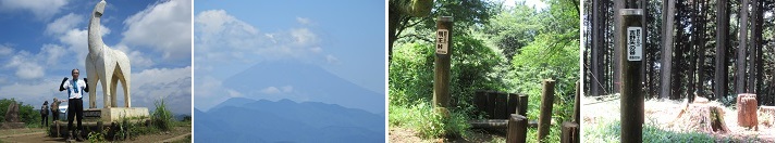
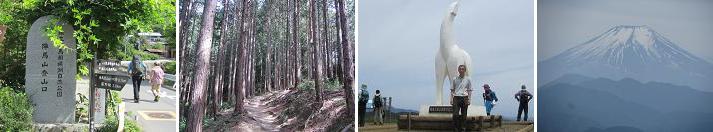
ü@*Mt. Myoo Pass,(738meters) and Yanone(633meters):I climbed Mt. Jinba, Mt. Myoo Pass, and Yanone, one of the 15 famous mountains in Fujino. From Fujino Station on the JR Chuo Main Line, take the Kanachu Bus bound for Wada for 5 minutes and get off at the Jinbayama Tozanguchi bus stop. From here, we climbed 5 km and 140 minutes on the forest road with repeated zigzags and flat roads and the Ichino Ridge of log steps to reach the summit of Mt. Jimba (elevation 855 m). At the top of the mountain, there is a white horse statue named after the mountain. After a restroom break at the summit, we descended. On the way back, I walked 165 minutes to Sagamiko Station on the JR Chuo Main Line via Narako Pass, Myoo Pass, Yanone, and Yose Shrine. (2023year 10th of July)üB
ü@*Mineyama(570meters):I climbed Mineyama, one of Fujino's 15 famous mountains. I take the Kanagawa Chuo Bus bound for Yamanami Onsen for 10 minutes from Fujino Station on the JR Chuo Main Line and get off at the Yamanami Onsen Iriguchi bus stop. I walk in the order of Yamanami Onsen entrance bus stop - Okuwa trailhead - Mineyama - Furumine shrine - Ogane trailhead - Ogane bus stop. On the way back, I take the Kanagawa Chuo Bus bound for Fujino Station from Ogane bus stop for 20 minutes and get off at JR Chuo Main Line Fujino Station. Furumine Shrine is built on the flat top of this mountain. The enshrined deity is Yamato Takeru, whose divine virtues have been revered by the local people as a deity that leads to the fulfillment of all wishes, such as good luck and fire prevention. From the top, I was able to see Mt. Omuro, Mt. Tsumichi of the Nishitanzawa Mountains and Mt. Fuji. Three stone pagodas of "Fujin", "Ryuujin" and "Suijin" are built at a place slightly down from the top of Mineyama. (2023year 17th of June)
ü@*Syoutousan(990meters),Kayamaru(1,019meters):Before the rainy season continued, I climbed Syoutousan and Kayamaru, one of Fujino's 15 famous mountains. Located on the border of Tokyo, Kanagawa, and Yamanashi prefectures, Syoutousan continues along a ridge of cherry blossoms, offering wonderful views of Mt. Fuji, Tanzawa, and the Southern Alps. I take the Tsukui Kanagawa Bus bound for Wada for 17 minutes from Fujino Station on the JR Chuo Main Line and get off at the Kamazawa Iriguchi bus stop. Kamazawa Iriguchi Bus Stop - Kamazawa Rest Area - Sanogawa Pass - Mikuni Pass - Syoutousan - Kayamaru - Renkomine - Yama no Kami - Yasaka Shrine - Wada Bus Stop. The view of Mt.Fuji from Mt.Kayamaru was especially wonderful. The beauty of the Rhododendron azaleas and the chirping of the birds were soothing, and the energetic appearance of the weevils made for a memorable hike. (2023year 28th of May)
ü@*Nabewariyama(1,273meters):From Shibusawa Station, I take the Kanachu Bus bound for Okura for 15 minutes and get off at the last stop. Climb in the order of Okura üĘ (Nishirin Rindo) üĘ Futamata üĘ Ushirosawa-nokkoshi üĘ Nabewariyama Summit üĘ Nabewari Sanso. At Nabewari Sanso, you will stand in line and buy delicious nabeyaki udon and take a break. It's served hot in a clay pot and has a lot of ingredients, so it's very satisfying to eat! You can enjoy nabeyaki udon noodles in the spacious space at the top of the mountain while enjoying the spectacular view. After that, return to Okura on the original road with a piston. 17km, 6 hours and 36 minutes course. The tunnel of yellow colored autumn leaves is pleasing to the eyes of climbers. After visiting the Hadano Visitor Center, take the Kanachu Bus bound for Shibusawa Station from the Okura bus stop and get off at the final stop. The summit is flat and open, so on clear days you can see Mt. Fuji, the mountains of Nishi-Tanzawa, and the Kanto Plain.ü@(23th of October, 2022year)
ü@*Mt. Busukayama(747meters):From Hon-Atsugi Station on the Odakyu Line, I take the Kanachu Bus bound for Hanbara for 40 minutes and get off at the Yoriito Kumiai-mae bus stop. Hanbara Shrine -> trailhead -> Mt. Busukayama summit -> Miyagase-goe -> Hanbara Takatori mountaintop -> Miyagase Dam -> Aikawa Park. Walk 25 minutes from Aikawa Park Park Center to get to Hanbara bus stop, then take the Kanachu Bus bound for Atsugi Bus Center and get off at Hon-Atsugi Station. Bukkasan is a mountain with an altitude of 747m located in the eastern part of the Tanzawa mountain range. The trail is well maintained, making it easy for families to climb.It is an 8.0km, 4-hour hiking course that leads to Mt. Hanbara Takatori and Miyagase Dam. known as There is also an observatory (height 13m) at the top, from which you can see Higashi Tanzawa and the Kanto Plain. (11th of October, 2022year)
ü@*Azegamaru(1,293meters):From Shin-Matsuda Station, I take the Fujikyu Shonan Bus bound for Nishitanzawa Visitor Center for 70 minutes and get off at the last stop. Nishitanzawa Visitor CenterüĘShimotana FallsüĘZenrokunotawaüĘUnegamaru MountaintopüĘUnegamaru Shelter Hut, climb in order, take a break at the hut, and return to Nishitanzawa VC on the original road. 9.5 km, 5 hours 45 minutes course. From the Nishitanzawa VC bus stop, take the Fujikyu Shonan Bus bound for Shin-Matsuda Station and get off at the final stop. Unegamaru used to be a deep mountain with unspoilt nature, so much so that it was called a hidden peak in West Tanzawa. It is covered with a deep beech forest typical of Nishi-Tanzawa, and there is no view at all. Instead, you can see beautiful clear streams and two famous waterfalls called Shimodana and Booksana.ü@(4th of October, 2022year)
ü@*Takatoriyama(556 meters):I hiked Isehara Tonoyama Ryokuchi Park - Seiho - Mt. Takatori - Hibita Shrine. Take the bus from Tsurumaki Onsen Station for 5 minutes to Tsubonouchi bus stop, then walk 30 minutes to reach Tonoyama Ryokuchi Park Park Center. Tonoyama Ryokuchi Park Park Center üĘ Tonoyama (203m above sea level) üĘ Seiho (380m above sea level) üĘ Mt. Takatori (556m above sea level) üĘ (East ridge) üĘ Sannomiya Hibita Shrine. 9.5 km, 4 hours course. Take a 25-minute bus from the Hibita Shrine bus stop to Isehara Station. The Higashi Ridge was overgrown with weeds, and there were places where it was difficult to find the way, and twigs blocked the way, so it seemed that there were few users.ü@(21th of Septemver, 2022year)
ü@*Bandaisan(1,816meters):I take a taxi from JR Inawashiro Station to the Inawashiro Tozanguchi, and ride the summer mountain climbing lift from Inawashiro Ski Resort for 20 minutes. Numanodaira üĘ Tenguiwa at the 3rd station üĘ Kobo Shimizu hut üĘ Mt. Bandai summit. After enjoying the view at the summit, walk the way you came from Numanodaira üĘ Akahaniyama summit üĘ Inawashiro Ski Resort (11.8km, 5 hours 10 minutes), then walk further to the Inawashiro trailhead and JR Inawashiro Station (at the time of descent). without lifts or taxis). The Inawashiro Trailhead is where you can enjoy a walk through Numanodaira (a wetland surrounded by Mt. Bandai, Mt. Akahani, and Mt. It was a landscape that could be enjoyed only by climbing from.ü@(17th of September, 2022year)
ü@*Higaneyama (Jukokutoge, 771meters): From JR Atami Station, take the Izuhakone Bus bound for Hakone Sekisho / Motohakone for 35 minutes and get off at Atami Pass Bus Stop. Walk in the order of Atami Pass üĘ Higaneyama (Jukoku Pass) üĘ Himenosawa Park üĘ Higanesan Tokoji Temple üĘ Matsubayashi üĘ Higaneyama Trailhead üĘ Road along the Chitose River üĘ Kogome no Yu. Start descending to Yugawara / Ochiai Bridge while looking at Izu Oshima from Jukkokutoge. Walk along the road to the Yugawara branch via Nichikinzan Tokoji Temple. Since the Middle Ages, Nichikinzan has been walked by many people as a sacred place for Jizo worship where the spirits of the dead gather. Take a bath in Kogome no Yu and sweat. From the Ochiaibashi bus stop, take the Izuhakone bus to Yugawara station.ü@(28th of July, 2022year)
ü@*Mt. Takanashi(834meters):From Hakone Yumoto Station on the Hakone Mountain Railway, I take the Hakone Mountain Bus bound for Moto Hakone Port and get off at Hatajuku Bus Stop. If I go from Hatajuku along the Serpentine River for 50 minutes in the mountains, I will reach Hiryu no Taki. I take a rest while being healed by the sound of water flowing down from overhead. It is said that this waterfall, which is divided into two stages, the upper 15m and the lower 25m, is the largest waterfall in Kanagawa prefecture, and was the place of training for the trainees during the Kamakura period. Continue for 40 minutes in the mountains until you reach the summit of Mt. Takanashi. I have a table and chairs, so I have lunch here. On Mt. Takanashi, there is an information board about "Takasu Castle," one of the castles of Mt. Hakone, built by Mr. Gohojo in preparation for Hideyoshi Toyomi's attack on Odawara. Since the name of the mountain is the same as the name of the castle, a guide board is installed on Mt. Takanashi for convenience, but the exact location and scale of Mt. It is.ü@(2022year 13th of June)
ü@*Ryokamisan(1,723meters):From Seibu Chichibu Station, I take the Ogano Municipal Bus, change at the bus stop Spam of Yakushi, and get off at Hinata Otaniguchi Bus Stop. Take the Omotesando route (10.2km) for 7 hours and 30 minutes at Hinata Otaniguchi üĘ Kaisho üĘ Kiyotaki Hut üĘ Ryokami Shrine üĘ Ryokamisan üĘ Ryokami Shrine üĘ Kiyotaki hut üĘ Kaisho üĘ Hinata Otaniguchi. Take a bus from Hinata Otaniguchi bus stop and return to Seibu Chichibu station. Ryokamisan is attractive for its rich flowers that show the nature of Chichibu, and it begins to color from the end of March when spring begins, and the flowers of Akayashio and Mitsubatsuji are in full bloom from mid-April to May. The Omotesando route is popular as a route where you can enjoy the fun of mountain climbing, with a moderate mixture of gentle mountain trails and rapid climbs such as chains. Many stone Buddhas are enshrined in the middle of this course, and it is said that it is a mountain of ancient faith. (2022year 22th of May)
ü@*Makuyama(626meters):From JR Yugawara Station, I take the Hakone Tozan Bus bound for Makuyama Park and get off at the end point. The Makuyama course is a 7km, 3 hour and 40 minutes course for beginners who pass through Makuyama Park and climb Makuyama. Walk in the order of Makuyama Park üĘ Makuiwa üĘ Azumaya üĘ Makuyama summit üĘ Oishigadaira / Nangoyama branch üĘ Oishigadaira üĘ Ichinose üĘ Makuyama Park üĘ Kuroiwa Reservoir üĘ Goro Shrine. The biggest highlight is the beautiful scenery like a red and white carpet woven by 4000 plum trees that bloom in Makuyama Park from February. From the summit of Makuyama, you can enjoy a magnificent view overlooking the lush Sagami Nada and Manazuru Peninsula. In addition to plum blossoms, seasonal flowers such as rhododendrons, hydrangeas, and Kinmokusei are in bloom in Makuyama Park, so it is a course that you can enjoy in any season, such as May, June, and September. (2022year 15th of May)

ü@*Hakone Komagatake(1,356meters):From Hakone Yumoto Station, I take the Izuhakone Bus and get off at the Hakoneen Bus Stop. I take the Hakonekomagatake Ropeway from Hakone-En Station and get off at Komagatake Sancho Station. At the top of the mountain is the Hakone Motogu Shrine, which was once a sacred place for trainees. There is also an observation plaza at the top, and it is recommended to take a walk, overlooking a large panorama. Hakone Motogu on the mountaintop was rebuilt in 1964 as the inner shrine of Hakone Shrine, and since then the rituals have been rigorously rehabilitated and it is crowded with worshipers throughout the four seasons. The rock with the rope is called horse-falling stone, and it is said that the rock where the god descended on a white horse. The hole on the stone is a footstep of a horse, and the water that collects in the hole is a mysterious rock that is said to have never withered in drought.ü@(2022year 30th of April)
ü@*Mt. Kumotori(2,017meters),Nanatsuisiyama(1757meters),Shiraiwayama(1921meters):From Ome Station on the JR Ome Line, I take the Bus for 35 minutes and get off at the Kamozawa bus stop. I walk in order Day 1: 7 hours 40 minutes / 11.7km Kamozawa bus stop üĘ Dosho üĘ Nanatsuishiyama üĘ Mt. Kumotori üĘ Kumotori Sanso, Day 2: 6 hours 20 minutes / 9.1km Kumotori Sanso üĘ Shiraiwayama üĘ Okiyodai üĘ Kirimogamine üĘ Sanmine Shrine. From Mitsumine Shrine, take a minibus to Seibu Chichibu Station. Mt. Kumotori is the only 2000m peak in Tokyo and is the highest peak. It is the deep virgin forest that is typical of Okuchichibu and the view from the mountaintop are attractive. Due to the snowfall five days ago, I was able to climb a snowy mountain with crampons on, and in the latter half of the first day, the rain and wind became stronger with the passage of time, and it was difficult to go to the mountain while enduring the wind. It was a mountain climbing course organized by eight groups sponsored by Club Tourism with a mountain climbing guide. (2022year 26-27th of March)
ü@*Mt. Hakone Asama(802meters):From Odawara Station on the JR Tokaido Line, I take the Hakone Tozan Railway, change at "Hakone Yumoto" station, and get off at "Kowakudani" station. I walk in the order of Kowakudani Station üĘ Branch to Takanosuyama üĘ Miyanoshita Branch üĘ Mt. Hakone Asama üĘ Kowakudani Branch üĘ Branch to Takanosuyama üĘ Kowakudani Station. Mt. Hakone Asama is a mountain located in Hakone-machi, Ashigarashimo-gun, Kanagawa Prefecture, at an altitude of 802m, in the central part of Mt. Hakone. There are various mountaineering routes, and beginners as well as those who are not confident in their physical strength can easily enjoy the nature of Hakone. On the mountain climbing route departing from Kowakudani, you can see Chisuji Falls, which is also a healing spot with plenty of negative ions. The waterfall is attractive because the water is divided into streaks and gently and quietly flows down like a bamboo blind. (2022year 13th of March)
ü@*Mt. Sekiro(703meters):From Sagamiko Station on the JR Chuo Line, I take the Kanagawa Bus bound for Mikage for 6 minutes and get off at the Pleasure Forest Zen Bus Stop. I Walk in the order of bus stop in front of Pleasure Forest üĘ Daimeijin Observatory entrance üĘ Daimeijin Observatory üĘ Sekirozan summit. Mt. Sekiro is a mountain located in Sagamihara City, Kanagawa Prefecture, in the northern part of the Tanzawa Mountains. Lake Sagami is located at the northern foot of the mountain, and is one of the 100 famous mountains in the Kanto region. It is popular with day hikers because it is easy to climb. When viewed from the direction of Lake Sagami, the summit is flat and cannot be identified, but there is a sign for the summit of Mt. Sekiro at an altitude of 703m which is a triangulation point. (2021year 28th of November)

ü@*Daisen(1,729meters):From Yonago Station on the JR San-In Line, I take the Nihon Kotsu Bus bound for Daisenji and get off at the end. From there, I walk for 5 hours in the order of 6th station evacuation hut üĘ Misen üĘ 6th station evacuation hut üĘ Motoya üĘ Daisenji. Oyama became the third national park in Japan in 1922, and then in 1963, the Hiruzen area, Oki Islands, Shimane Peninsula, and Sanbeyama area were additionally designated and the current "Daisen-Oki" It became a "national park". Its beautiful nature continues to capture people's hearts so that it is selected as the best 3 in the "Japan Famous Peak Ranking". It is a compound volcano that is very different from Mt. Fuji. It consists of an old stratovolcano and a new bell-shaped volcano. Violent erosion and collapse form steep cliffs on the south and north walls. Unlike the landscape on the west side with a gentle slope, it depicts a steep mountain landscape. (2021year 11th of October)
ü@*Mt. Iwaki(1,625meters):From Hirosaki Station on the JR Umba Main Line, I take the Konan Bus shuttle bus for 1 hour and 20 minutes, and get off at The Eighth Station Bus Theminal. From there, I walk to The Yatsumi üĘ Bird's SeaüĘ Mt. Ishiki SummitüĘ Iwakiyama OkumiyaüĘ Forest BeltüĘ Yatsumi üĘTake Onsen. I take the Konan Bus at the Take Onsen bus stop and get to Hirosaki Station in 1 hour. Mt. Iwagi is a double volcano located in the southwestern part of the Tsugaru Plain, and is the highest mountain in Aomori Prefecture with a mountain shape, a mountaintop that is three peaks. A hot spring gushed out in Yamarei, and the Tsugaru Iwagi skyline was completed until the 8th station in 1966. In 1985, it was designated as the 50th National Monument, and around the 9th station, alpine plants unique to Mt. Ikki bloom from July to August. (2021year 13th of September)
ü@*Gassan(1,984meters):From Yamagata Station on the JR Ou Line, I take the Yamako Bus for 1 hour, get off at Gassanguchi Bus Stop, change to the Nishikawa Municipal Bus for 20 minutes, and get off at Gassan Masuzawa Bus Stop. I take the Gassan pair lift from the lower station to the upper station and walk in the order of Ubagatake üĘ Ushikubi üĘ Gassan. Gassan is a semi-circular Aspide-type volcano that is rare in the world, and there is a Gassan Shrine at the top of the volcano. The shrine is widely worshiped by the general public as an agricultural god who controls water and as a god of voyage fishing. Gassan has many special plants found in high mountains such as high moors, alpine plants, and subalpine coniferous forests, and rare animals such as okojo and alpine accentor have been confirmed and designated as a natural monument. (2021year 11th of September)
ü@*Mt. Mitutouge(1,785meters):From Kawaguchiko Station on the Fujikyuko Line, I take the Fujikyuko Bus for 5 minutes and get off at the Kawaguchiko Ropeway entrance bus stop. From the shore of Lake Kawaguchi, I take the "Mt. Fuji Panorama Ropeway" to Mt. Tenjo. Climbing to Mitsutoge has finally started from the summit of Mt. Tenjo. After passing through Mt. Shimoyama and Mt. Kinashi, we arrived at the summit of Mitsutogeyama in three and a half hours and took a break before starting to descend to the Mitsutoge station side. After passing the Tatsuma stone at the foot of the mountain, we arrived at Mitsutoge station in two and a half hours. In 1945, the Fujisanroku Electric Railway (currently Fuji Kyuko) started commercial operation, and was operating a train around 3 o'clock in the early morning to also transport newspapers. (2021year 6th of March)
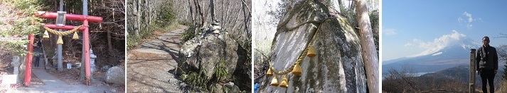
ü@*Isiwariyama(1,413meters):From Mt. Fuji Station on the Fujikyu Line, I take the Fujikyu Bus for 40 minutes and get off at the Ishiwariyama entrance bus stop. I climb a gentle mountain road for about 40 minutes to reach Fujimidaira. After about 30 minutes, Ishiwari Shrine where a huge rock is enshrined. From here to the summit, the course is quite steep. There are exposed rocks and tree roots at your feet, so you need to be careful, but you can climb with confidence because the rope is stretched in slippery places. In about 20 minutes, the surrounding area suddenly opened and we arrived at the summit of Mt. Ishiwari. With a magnificent view of Mt. Fuji in front of you and Lake Yamanaka below, you can enjoy the satisfaction that will blow away your tiredness. Ishiwari Shrine is a shrine that sits at the 8th station of Mt. Ishiwari and is said that the name of Ishiwari Shrine was given because the large rock of the Shintai is broken like a stone. (2021year 7th of February)
ü@*Kanegatake(561meters):From the Odakyu Odawara Line Hon-Atsugi Station Bus Center, I take the Kanagawa Bus bound for Nanasawa for 35 minutes and get off at the Hirosawaji hot spring entrance bus stop. I walk in the order of the Hirosawaji hot spring entrance bus stop üĘ Asama Shrine üĘ Kanegatake summit üĘ Yamanojin Pass üĘ Hirosawaji Onsen üĘ the Hirosawaji hot spring entrance bus stop. From the entrance of Kanegatake to Asama Shrine in front of the summit, there are 28 paths, and stone monuments from 1 to 28 are placed at each location. After passing through the torii gate and proceeding along the field road, you will soon see a bell-shaped mountain with an altitude of 561 meters. Asama Shrine is located after climbing the steep slope where the stone monument and stone Buddha are placed. If you go to the left in front of the shrine, you will soon reach the spacious summit. (2021year 3rd of January)
ü@*Mt. Musashi Mitake(929meters):From Mitake Station on the JR Ome Line, I take the Nishi Tokyo Bus cable for 7 minutes, get off at the cable car bus stop, and climb a little uphill to reach Kalebukar Takimoto Station. I take the cable car for 6 minutes and get off at the cable car Mitakeyama station. I walk in the order of cable car Mitakesan Station üĘ Mitake Visitor Center üĘ Musashi Mitake Shrine (Mt. Mitake) üĘ Nagaodaira üĘ Nanayo Falls üĘ Rock Garden üĘ Ayahiro Falls üĘ cable car Mitakesan Station. Mt. Musashi Mitake is a mountain of worship that has been worshiped as a sacred mountain since ancient times. It is widely known as a mountain where you can easily walk around the rich nature throughout the four seasons. (2020year 13th of December)
ü@*Ohnoyama(723meters):I Walk in the order of JR Gotemba Line Yaga Station üĘ Onoyama Hiking Course Entrance üĘ Onoyama Summit üĘ Makibakan üĘ Fukasawa Sansoji üĘ Fukasawa / Furujuku branch üĘ Onoyama entrance bus stop. Onoyama is a typical mountain in the southwestern part of the Tanzawa Mountains, and the area around the summit is a ranch, which is a gentle grass mountain. From the grassland-like summit, you can see Lake Tanzawa and Tanzawa, Mt. Fuji, the mountains of Hakone, and the Ashigara Plain, making it a great observatory. While lying on the meadow, you can look up at Mt. Fuji and enjoy the view of the mountains of Tanzawa and Hakone under your feet to your heart's content. From mid-October to mid-November, you can see the beautiful silver-fluttering sea bass meadows. Mt. Fuji over Japanese pampas grass is also fantastic. (2020year 15th of November)
ü@*Takamatuyama(801meters):From Yamakita Station on the JR Gotemba Line, I take the Fujikyu Shonan Bus bound for Shin-Matsuda Station for 5 minutes and get off at the Takamatsuyama entrance bus stop. I walk in the order of Takamatsuyama entrance bus stop üĘ branch üĘ Biri-do üĘ Takamatsuyama summit. Takamatsuyama is one of the avant-garde mountains on the south side of the Tanzawa Mountains, and is a mountain that many people visit for hiking along with Onoyama, which is next to the west. There are many mandarin orange fields on the south slope, and it is beautiful from late autumn to early winter when the oranges are colored. From the summit, you can see Mt. Fuji, the direction of Odawara, and the mountains of Tanzawa from among the trees. Biri-do is a Jizo statue that appears on the way to Takamatsuyama. Hayagriva is often seen in this area. (2020year 8th of November)
ü@*Okushirane(2,578meters):From Numata Station on the JR Joetsu Line, take the Kanetsu Kotsu Bus bound for Oshimizu for 1 hour and 10 minutes and get off at Kamata Bus Stop, then transfer to the Kanetsu Kotsu Bus for Yumoto Onsen 25 minutes and get off at the Nikko Shiraneyama Ropeway Bus Stop and take the ropeway for 15 minutes and get off at the Summit Station. I walk in order of Summit Station - Shichikidaira branch - Mt.Okushirane. Okushirane is the highest peak north of the Kanto region. Okushirane is surrounded by mountains of the Shirane volcano and is often hidden by clouds throughout the year. From the Kanto region, on the ridge of the Nikko mountain range, It can be seen only to the extent that a dome-shaped (Quaternary volcano) projection on the summit of Shirane is placed. (2020year 25th of October)
ü@*Yaguradake(870meters):From JR Odawara Station, I take the Daiyuzan Line for 20 minutes and get off at Daiyuzan Station, then take the Hakone Tozan Bus for 15 minutes from Sekimoto Bus Stop and get off at Yakurazawa Bus Stop. I walk in the order of Yagurasawa üĘ Guard fence üĘ Yagurasawa summit üĘ Yamabushidaira üĘ Jizo-do. I take the Hakone Tozan Bus from Jizodo Bus Stop to Sekimoto Bus Stop for 25 minutes and return to Daiyuzan Station. Yaguradake is a mountain located in the Ashigara Mountains between the Hakone Mountains and Tanzawa Mountains in western Kanagawa Prefecture, and is located on the north side of Mt. It has a characteristic mountain range like standing onigiri, and because it is an independent mountain in the Ashigara Mountains, it has a 360-degree view, and the mountains of the Hakone Mountains such as Mt. Fuji. You can see the mountains and Sagami Bay. (2020year 21th of October)
ü@*Myouzingatake(1,169meters):From JR Odawara Station, I take the Daiyuzan Line for 20 minutes and get off at Daiyuzan Station, then I take the Izuhakone Bus for 10 minutes and get off at the Ryoson Bus Stop. I walk in the order of Daiyuzan Saijoji Temple üĘ Miharu Hut üĘ Myojingatake üĘ Hiutiishidake üĘ Katakurazawa Pass üĘ Mt. Kintoki trailhead. Myojingatake is a mountain with an altitude of 1,169 meters on the border between Minamiashigara City and Hakone Town in Kanagawa Prefecture. It is one of the ancient outer ring mountains of Mt. From the precincts of Saijoji Temple, climb the wild road to Myojingatake. After passing through the planted forest, you can overlook Lake Sagami to Tanzawa, and the wild grasses beside the course welcome hikers. From the top of Mt. Myojingatake, you can enjoy a magnificent view of Mt. Fuji over Mt. Kintoki and Hakone below. (2020year 28th of September)
ü@*Utukusigahara(2,023meters):It is about 18 km from Matsumoto IC on the Nagano Expressway to Sanjo Ikoi Plaza via Prefectural Road Nos. 67 and 283 by private car, and I arrive at the free parking lot in front of the center house. I walk in the order of Sanjo Ikoi Square -> Hirokiba -> Beautiful tower -> Wanggato -> Sanjo-so-mae. Utukusigahara has long been known as a scenic spot for a vast plateau. It is a plateau at an altitude of 2000 m, and there are no high mountains in the vicinity, and you can enjoy a 360-degree panoramic view. Three Alps in the north, center, and south, Yatsugatake, mt. Fuji can be seen in the distance if the weather is good. The Utukusigahara Plateau is a treasure trove of alpine plants, especially the japanese azalea, which blooms from late June to early July, is famous for its grazing cows and set photos. (2020year 16th of September)
ü@*Norikura(3,026meters):I take the Matsumoto Dentetsu Bus from Shin Shimazuma Station to Norikura Kogen Kanko Center. Change to a shuttle bus and take a 50-minute ride to the top of Norikura (Tatamidaira) and get off. I walk in order of Tatamidaira - Katanohutai - Norikura (Kenga Peak). Norikura is an active volcano with a white surface near the summit, but it was erupted in 1882. In the past, greenery used to spread to the area around the crater. There are several crater lakes near the summit, which are called Yugama, Mizugama and Dry Cauldron. The site is characterized by a monogenetic volcanic group with many craters and lava vents clustered around the summit. The lake water has a cloudy blue-green color due to the absorption of specific wavelengths of light by iron ions and sulfur in the water. (2020year 9th of August)
ü@*Kinpusan(2,599meters):From Katsunuma IC on the Chuo Expressway, I take a private car, take National Highway No. 20, 411, Prefectural Road No. 208, and Kawakami Makioka Forest Road for 45 km, and reach the free parking lot at Oharatoge in two and a half hours. I take the walk in order Oharatoge - Asahidake - Kinpusan. Kinpusan rises across Kofu City, Hokuto City, and Kawakami Village in Nagano Prefecture, boasts both the name and reality of a mountain suitable for the leader of Oku-Chichibu. There are several mountaineering courses in the north, south, east and west, but the one-way, two-hour, 30-minute course that enters from the Otaru Pass, which is on the border of Makioka Town in Yamanashi City and Kawakami Village in Nagano Prefecture, is the easiest to climb, and is a popular course for beginners and middle-aged and elderly people. (2020year 19th of July)
ü@*Mt.Mizugaki(2,230meters):Get off at the Sutama IC on the Chuo Expressway in my own car, head for Lake Mizugaki and Masutomi. When I come to Lake Mizugaki, turn right in the direction of Masutomi. Get to the free parking lot. I take walk on order Mizugaki Sanso - Fujimidai Koya - Amaginagawa - Mt.Mizugaki. Mt. Mizugaki is formed by all rocks and biotite granite rocks. The greenery and autumn colors are one of the best scenic spots in Japan, in harmony with the huge rocks of the coniferous forest and the broad-leaved forest of birch. The summit is a group of huge rocks, where several dozen people can rest. The south side is cut off and the legs are shrugged. Mt. Fuji, Mt. Kinho, and Mt. Kokushigatake can be seen to the south, and the rocky mountains such as the large file rock can be seen from directly above. (2020year 24th of June)
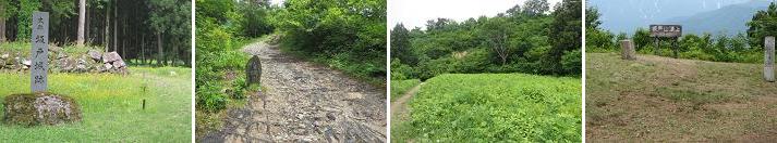
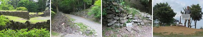
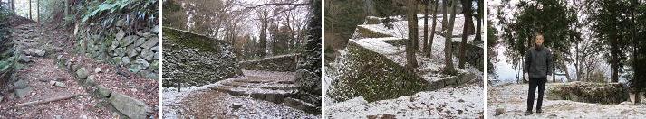
ü@*Mt.Sakado(634meters):It is a 20-minute walk from JR Joetsu Line Muikacho Station and arrives at Torisaka Shrine at the climbing mouth. I walk on the pharmacist ridge course of the mountain trail, arrive at Mt.Sakado summit where Sakado Castle's main stone exists. Sakado Castle is a large mountain castle located in Minamiuonuma City, with a main stone at the top of the mountain and a tomb of the residence at the foot of the mountain in the middle of the mountain, located across the Uonogawa River overlooking the Mikuni Highway. Known as Mr. Ueda Nagao Yukari castle, he is well-known as the castle of Nagao Masaki and Uesugi Shikabane. There are large scale Horikiri in the main points of the Yamagami ridge, and Ishigaki remains in the eastern slope of "Honmaru". In the vicinity of the ridge extending southwest from the summit there is a trace of "Nishinomaru".(2019year 2nd of June)
ü@*Mt. Tunomure(576meters):I take a taxi from JR Kyudai line Bungomori station, arrive at a Sannomaru parking lot by 15 minutes and get off. I arrive at the inner citadel trace where it's in a mountain top via Ninomaru trace in 15 minutes on foot from there. Tunomura castle is known as the natural stronghold castle where it didn't give up in case of a war of Mr. Shimazu and Mr. Otomo in 1585-1586. Castle is surrounded by a small wooden stand at a steep steep rock face. A castle was repaired substantially when Takamasa Mouri enter into the castle in 1593. The remains for which it's left at present seem something in this time. In the Edo Period, Kurushima Yasuchika entered here from Iyo, a forest feudal clan is established, Mr. Kurushima built Kushima Jinya in the foot of a mountain because he didn't permit having a castle by 14,000 stones of small daimyo, and Tunomura castle was made a deserted castle. (2019year 17th of May)
ü@*Asahiyama(785meters):It is a 60-minute walk from Nagano Shinkansen Nagano Station. I arrive at Asahiyama climbing mouth after passing through Asahiyama Kannondo. Asahiyama Castle is the castle which became the stage of Battle of the Second Kawanakajima. Asahiyama is a mountain having a triangle rising behind the Nagano prefectural office in the west side of Nagano city area. On the east side of Asahiyama the hem Han River flows with a cliff, The southern side is a natural moat of Saikawa, it is a very tough location. Takeda Shingen who pulled Mr. Kurita, the host of Zenkoji to a friend has built castle to constrain Kawanakajima Advancement of Nagao Kagetora. As opposed to opposition for several months, as a result of stalemate, a reunion was established by mediation of Imagawa Yoshimoto. In 1557 years Kagetora rebuilt the castle. At present it is possible to check the remains such as masonry in the castle ruins.(2018year 23th of September)
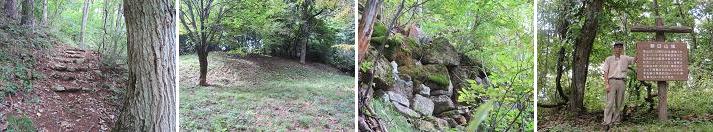
ü@*Mt. Yamizo(1,022meters):I get on a bus from JR Suigun Line Hitachi-Daigo Station for 45 minutes and I get off in a terminal and I climb the steep mountain path from Yamizo forest road entrances for two hours and arrive at the sun temple at the eighth stage of Mt. Yamizo. After having prayed in a main shrine, I submit copying of a sutra of the Pajna-para-mita sutra that prepared and have a sealed letter in a copied sutra book. I arrive at Yamizo Peak Shrine in top of Mt. Yamizo for 30 minutes and take a souvenir picture afterwards. I can look at the Pacific from the top. The propagating Buddhism Great Teacher ticked away a Kannon with eleven faces in 807 year and did it with hallowed ground. It prospered very much in the Muromachi era, but it is said that it has become the small temple by the later fire and an anti-Buddhist movement of the Meiji era now. (2016year 5th of December)
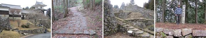
ü@*Mt. Gagyu(687meters):I arrive at the outworks of a castle park from JR Takayama Line Takayama Station in a 25-minute walk and arrive at Mt. Gagyu mountaintop in a 15-minute walk. Takayama Castle was constructed on Mt. Gagyu mountain in 1444 through 1449 year by Noriyuki Tagayama who was a sub-military commissioner of Hida. Nagachika Kanamori received a command of Hideyoshi in 1585 year, invaded and attacked, and a main enclosure, the outworks of a castle were completed from 1588 year until 1600 year, and outermost outworks were built in three years afterward by Yoshishige Kanamori. Gay quarters, a moat, a stone wall, fieldwork remain as remains of an ancient structure. (2016year 6th of June)
ü@*Mt. Iwabitu(803meters):I arrive at up Chengkou from the JR Agatsuma Line Satohara station in a 30-minute walk and I walk 15 minutes from there to a main enclosure. Iwabitu castle is built in the ridge to increase northeast of Mt. Iwabitu. Main enclosure, second maru, Zhongcheng spreads out from the west. It was constructed a castle early in the Kamakura era by Azuma Tarou. It became the place that Saito ruled over, and Shingen Takeda gave chief vassal Yukitaka Sanada an order for Iwabitu castle capture for Joshu aggression in 1563 year. The lord of a castle Motoi Saito benefited an impregnable castle and fought hard, but it fell and Shingen gave Yukitaka an order for the protection of Agatsuma-gun. Yukitaka died in 1574 year, and a sincerity net of the eldest child fitted into lord of Iwabitu castle, but third son, Masayuki of Yukitaka succeeded to the Sanadas because Nobutuna and Masateru brother were killed in action by a war of Nagashino in the next year. Eldest son Nobuyuki of Masayuki ruled. (2016year 13th of March)
ü@*Mt. Iwatono(634meters):I arrive at "the hall of the Mt. Iwadono contact" from JR East Chuo Main Line Otsuki Station in a 30-minute walk. Furthermore, it is in a 30-minute walk through guard station, riding ground, storehouse mansion, dried foss, well water and arrives at the Iwadono mountain range top. Iwadono Castle was built by Nobuari Oyamada who got the job as a chief vassal in influential local people of the worth to Takeda in 1532 year. Oyamada fought against Takeda of the worth protection, but he is affiliated with Takeda with keeping the position of the feudal lord of the partial independence to possess the county in 1509 year and is given an important post. When Nobunaga Oda invaded and attacked in worth in 1582 year, Nobushige Oyamada went over to Oda and prevented county income of Katsuyori Takeda who was going to escape from a new provincial castle to Iwadono Castle. Katsusada at a loss for the advance killed himself. (2015year 20th of September)
ü@*Mt. Yougai(770 meters):It is 15 minutes by taxi from JR Chuo Main Line Kofu Station to the Mt. Yougai starting point of a mountain climb. It is a 40-minute walk from the starting point of a mountain climb to the mountaintop. A fort and the beacon level were built in Yougaisan Castle built in the Mt. Yougai as a filling castle of the Takeda building in 1520year of the Nobutora Takeda. Military commander Masashige Fukushima of the Imagawa group of Suruga attacked Kai and pressed Kofu for Suruga Province street in the same year, and Nobutora Takeda evacuated wife Ooi and expelled Fukushima group, but the wife Ooi delivered Harunobu Takeda in a castle. A passage to the main enclosure, a square, gay quarters, Horikiri, a crow's nest, wells of an ancient structure and the stone wall are remained. Katsuyori Takeda issued a carrier reminder and gave an order for repairing of Yougaisan Castle in 1576year. (2015year 1st of June)
ü@*Mt, Takatori(583meters):Get off at Kintetsu train Yoshino Line Tsubosakayama Station, fall in "Tsubosaka Teraguchi" by Nara Kotsu bus for ten minutes and walk 90-minute. I walk the road of the uphill slope and arrive at Gohyaku Rakan. I continue climbing the road of meanders to Takatori Castle trace. Furthermore, there is a steep slope, and there is the point of a high step and arrives at a main enclosure trace. In the Takatori Castle, it is conveyed with an opening for Genko era two years (1332 year)of north and south morning service charges that Kunizumi Ochi constructed a castle in. Plottage was the widest among Yamashiro, and was built, and a castle tower and 29 oars of the white plaster coating seemed to be displayed in the going. (2014year 15th of December)
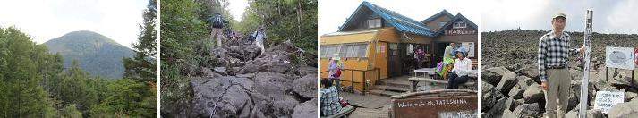
ü@*Mt. Tatechina(2,530meters):I arrive at the parking lot of the Tatechina ranch from Chuo Expressway Suwa South IC by privately-owned car via National highway No. 152 in one hour. I get down on artificial pond nature garden with the gondola lift of the Tatechina ranch and appear in front of Tatechina mountain cottage when I walk the mountain trail for approximately one hour 30 minutes. I arrive at the mountaintop for approximately 40 minutes and enjoy a vast panorama of 360 degrees to view Yatsugatake and the Japan Alps. An alpine plant makes it bloom in a gap of the lava, and the mountaintop part colors summer of Mount Tateshina in spite of being violent crater sign. After having taken a break, I dropped carefully and returned in the steep slope to Tatechina mountain cottage in the parking lot of the Tatechina ranch. (2014year 31th of August)
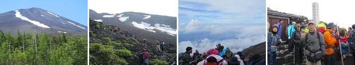
ü@*Mt. Fuji(3,776meters):I arrive at the Kawaguchiko fifth stage by bus. I climbed the mountain trail of the lava grit with the falling rock prevention fence zigzag for five hours. I consumed dinner in a mountain hut at the eighth stage and took the nap. I climbed the Yoshida mouth mountain trail of the Iwao root slowly for five hours since middle of the night 23. I arrived at the Yoshida mouth top, and the east sky began to be dyed orange, and the morning sun rose on a sea of clouds. The descent from a mountain entered the way for exclusive use of a descent from a mountain cut to lava grit zigzag at the Yoshida mouth top and came back to the fifth stage on foot for five hours. (2014year 12th and 13th of July)
ü@*Mt. Nantai(2,486meters):I take a bus from Tobu-Nikko Station for 50 minutes and get off in bus stop "Futara-san-jinja Shrine". I put an admission fee to a temple after an entry in the shrine office of Futara-san-jinja Shrine Chuguushi and I finally tramp over hills. I continue climbing steep Mountain climbing road to the mountaintop for three hours. I sometimes take a break in the middle of Mountain climbing road and it is healed by the view of Lake Chuzenji to see under eyes and gets spirit. I finish climbing Mountain climbing road and arrive at the top of Mt. Nantai and take a souvenir picture at the side of the image of a deity of Futara Big God tanding in the high place of the Futara-san-jinja Shrine deepest-placed shrine in a manly way. After having enjoyed the view of Nikko Mountains, I return by the route same as an outward trip. (2014year 1st of June)
ü@*Mt. Akagi(1,828meters):I arrived to Mt. Akagi visitor center by privately-owned car from Kanetsu Expressway "Maebashi IC". Mt. Akagi is a generic name of Mt. Kuroso and Mt. Komagatake. I change into mountain climbing shoes and go to Mt. Kuroso entrance. I arrive at Mt. Kurosa entrance after praying safely in Akagi Shrine. When I climb in forest for one hour, the blue surface of the water of Onuma glitters under eyes. I finish climbing the ridge way and arrive at the top (1,828m) of Mt. Kuroso and take a souvenir picture. After having enjoyed a view of Tanigawadake and Mt. Hotaka and Mt. Sukai, I climb the ridgeline gently back after going south and appear in the top of Mt. Komagatake. After having seen Mt. Kuroso from Mt. Komagatake, I suddenly dropped from the hillside after withdrawing gently and arrived at the Mt. Komagatake starting point of a mountain climb. (2014year 18th of May)
ü@*Iwamura Shiroyama(717meters):I arrived at the Iwamura history museum by car from Chuo Expressway "Ena IC" for 25 minutes. After having observed the front gate, the Hirashige gate, the drum oar at the foot and the restored feudal lord's house, I climbed a slope and the stairs to outermost outworks, the outworks of a castle, six setoffs, a main enclosure small back gate, a main enclosure via Ote-mon Gate of the Iwamura castle for 25 minutes. I descended a mountain after observing fortress, the dried rice cake storehouse and came back to the Iwamura history museum. The Iwamura Castle is located to 717m above see level. Chief vassal of Yoritomo Minamoto, Kagekado Kato is assigned to a lord of a manor of this ground in 1185, Toyama Kagetomo is constructed the Iwamura Castle in 1221. (2014year 21th of March)
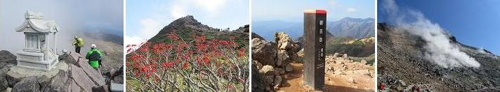
ü@*Mt. Nasu (1,917meters):I went by bus from Kuroiso Station of JR Tohoku Main Line to Nasu ropeway Station and got off and got on the Nasu ropeway from foot of a mountain Station to mountaintop Station. The bus delayed in a traffic jam. I climbed the slope of the grit and stood in the top of Mt. Chausu (1,915m). There was a small Nasudake Shrine in the top and prayed safely. After having enjoyed the prospects from the top, I went down the crater edge and arrived at the refuge hut and ate "the rice ball" and took a break. I climbed the slope of the rock and arrived at the top of Mt. Asahi (1,896m). After having surveyed Mt. Chausu and Mt. ThreeSpear (1,917m) from here, I returned to refuge hut and crossed the middle of Mt. Chausu horizontally. I went down through the neighborhood of the fumarole that smoked lively and came back to mountaintop Station of the Nasu ropeway. (2013year 14th of October)
ü@*Mt.Hatimantai (1,613meters):I got on a bus at JR Tohoku Shinkansen Morioka Station and got off a bus at a reward mountain pass. I looked at Mt.Motsuko (1,578m) which showed off a tetrahedron and Mt.Iwate (2,038m) from the reward mountain pass. I arrived at the Mt.Hachimantai top (1,613meters) from the reward mountain pass on foot for 30 minutes and took a souvenir picture, but there were a reed mace marsh and a mirror marsh on the way, and colored leaves were seen in neighboring several places. I returned by the route where was different from the outward trip on foot to the reward mountain pass for 30 minutes after I ate "the rice ball" on Mt.Hachimantai top. I moved to deepest Lake Tazawa-ko in Japan by bus afterwards. Lake Tazawa-ko was colored of the azure by surface of a lake and Legend of Princess Tatsuko and I took a walk through 10 kilometers from the place with drinking water man figure to the place with princess Tatsuko figure along a promenade. (2013year 26th of September)
ü@*Mt.Tanigawa (1,977meters):I climbed Mt.Tanigawa of dual ear pass of the Joetsu border that show an Alpen-like scene and soared. (2013year 31th of July) Course:JR Tokyo Station üĘ Toki No.301 üĘ JR Takasaki Station üĘ JR Joetsu Line üĘ JR Minakami Station üĘ Bus to Mt.Tanigawa Ropeway üĘ Ropeway Tanigawa ogou Entrance Station üĘ Start Ropeway üĘ Tenzindaira üĘ Tenzin Pass üĘ Kumaanazawa Refuge hut üĘ Gathering place of the long-nosed goblin üĘ Hut of Shoulder üĘ Ear of Toma üĘ Mt.Tanigawa mountaintop/Ear of Oki üĘ Ear of Toma üĘ Hut of Shoulder üĘ Lunch Rice Ball üĘ Gathering place of the long-nosed goblin üĘ Kumaanazawa Refuge hut üĘ Tenzinaira üĘLunch Curry Rice üĘ Ropeway Tanigawa ogou Entrance Station üĘ Bus to MinakamiStation üĘ JR Minakami Station üĘ JR Joetsu Line üĘ JR Takasaki Station üĘ Asama No.534 üĘ JR Tokyo Station
ü@*Mt.WestHotaka (2,909meters):I arrived at Mt. WestHotaka entrance Station of 2,150m on a bus for exclusive use from Shinjuku to Shin-Hotaka Spar afterwards on a ropeway. I eated breakfast in an observation deck and watched Mt. WestHotaka and Nisiho Symbol. I arrived at the Nisiho Cottage in a forest zone for one hour & 30 minutes. I arrived at Nisiho Symbol of 2,701m between creeping pines from the Nisiho Cottage. Unfortunately, gas was full and could not see the scenery of the circumference, and wind blew to the neighborhood of mountaintop of Nisiho Symbol. I took a picture and left off the climbing to Mt. WestHotaka and eated lunch at Nisiho Cottage. I walked in a forest zone towards Kamikochi from Nisiho Cottage for three hours. I was in time for 16:00 of the train time of the bus for exclusive use from Kamikochi to Shinjuku. (2013year 22th of July)
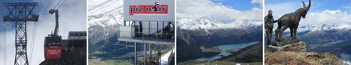
ü@*Mt.PizNair (3,057meters):After having looked at the buildings such as a church or the art museum in Saint Moritz, I arrived at the PizNair observation deck at the summit of Mt. PizNair of 3,057meters above sea level with a cable car and a ropeway. I was able to see Alpine marmots of the Sciuridae going out of the den and jumping up and down many times from the ropeway. I was able to look at Lake Saint Moritz and Lake Silvaplauna and the mountains of the 3,000meters class neatly from the mountaintop. After having had lunch in PizNair observation deck, I took a souvenir picture with the image of the Alpine ibex of the Bovidae at the mountaintop. (2013year 26th of June PM)
ü@*Mt.PizBernina (4,049meters):I moved to Saint Moritz on the day before while taking a glacier limited express and enjoying the landscapes and the inside of car food such as Rhine gorge Valley and Landwasser bridges from a panoramic vehicle. I took a Bernina railroad at Saint Moritz and got off at Bernina Diavolezza Station and arrived at the Diavolezza observation deck of 2,978meters above sea level using Bernina Alps sightseeing ropeway. From the ropeway, I was able to look around big lake LagoBianco in the halfway up a mountain. From Diavolezza observation deck, a superb view of beautiful mountain group such as Mt. highest peak PizBernina or the Mt. PizPalue and the large force glaciers are opened under my nose. I descended a mountain with a ropeway and a Bernina railroad same as an outward trip after enjoying a superb view and came back to Saint Moritz. (2013year 26th of June AM)
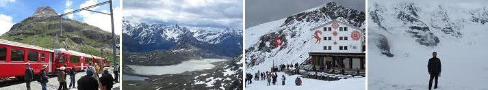
ü@*Mt.MonteRosa (4,634meters):When I got on the mountain railway of the Gornergrat railroad in Zermatt of 1,620m above sea level for approximately 50 minutes and arrived at Gornergrat Station of the terminal, the Switzerland Alps and a glacier of the 4,000m grade opened under my nose in the open space of the station square. I took a souvenir picture backed by Swiss highest peak Monte Rosa mountain in a walk, a rocky place of there to an observation deck and the prospects space on the station square. I was able to watch Mt. of 4,634m above sea level Monte Rosa, Liscam mountain of 4,527m above sea level, BrightHorn mountain of 4,164m above sea level, Gornergrat glacier, Grenz glacier clearly from an observation deck. (2013year 23th of June)

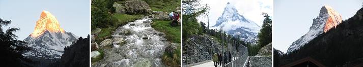
ü@*Mt. MatterHorn (4,478meters):Zermatt is the mountains resort where the entry of gasoline cars was prohibited and can enjoy a quiet atmosphere and fresh air to one's heart's content. I was able to watch the Matterhorn stained with morning glow from Zermatt of this 1,620m above sea level. I got off on the mountain railway of the Gornergrat railroad in the third station Riffelalp (2,222m) in Zermatt and hiked and enjoyed a beautiful Alpine mountain range including the Matterhorn. I descended a mountain in Zermatt and thought the march of the goat in a station square street fortunately at about half past 4 in the evening. In addition, I was able to watch the Matterhorn stained with the setting sun. I was able to thoroughly enjoy the view of Matterhorn which changed an expression wealthily by time. (2013year 23th of June)
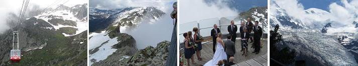
ü@*Mt. MontBlanc (4,807meters):Towards Mt. Mont Blanc of the European Alps highest peak, I went on an exclusive bus from Zurich to Chamonix of 1,030m above sea level through Bern, Montreux, Martigny over Switzerland and the French border for approximately five hours. I got on the ropeway in Chamonix for twice, approximately 20 minutes and arrived at the brevan observation deck of 2,525m above sea level. In the brevan observation deck, I happened to meet the couple who held a wedding ceremony. The weather of the sky was not good, but was able to look at the Mont Blanc mountain which barely meant "a white mountain" from the gap of the cloud towards the depths of the big glacier. (2013year 22th of June)
ü@*Mt. Azuma (2,035meters):I got off a bus from JR Yamagata Shinkansen Yonezawa Station in Shirafu Yumoto of the terminal and went up to Hokuboudai of 1,820m above sea level in a ropeway and a lift. The temperature was 23 degrees in Yonezawa, but it was 16 degrees in Hokuboudai, but an alpine plant bloomed. There was firm remaining snow of snow 1m and was hard to know a mountain trail, and a part of the forest zone got a wrong course many times and came back. I finally arrived at the mountaintop through Figure Stone, a Brahma the Creator rock and a long-nosed goblin rock on foot for 150 minutes. In the mountaintop, there is not the thing which you should watch including the prospects only by there being the beacon. I returned to Hokuboudai on foot via West Azuma hut, Azuma Shrine, a long-nosed goblin rock and observation deck for 120 minutes. (2013year 10th of June)
ü@*Mt. Jinba (857meters):There was the mark of the Mt. Jinba starting point when I walked from JR Tyuou Main Line Fujino Station for 30 minutes. I climbed up the zigzag and one ridge of the stairs of a forest road and the log of the repetition of a flat way from here for 5km, 100 minutes and arrived at the summit of Mt. Jinba. There was a white horse image associated with Mt. name widely in the place, and the large prospects of 360 degrees opened it, and Oku-Tama, Tanzawa, the mountains along the Tyuou Main Line looked around the mountaintop from the Kanto plains, and Mt. Fuji was particularly beautiful. I descended a mountain after I ate soba in a teahouse. The returns walked to JR Tyuou Main Line Sagamiko Station via Narashi Pass, Keiou Pass, Yose Shrine for 145 minutes. (2013year 1st of June)
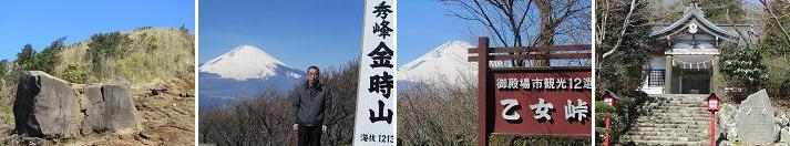
ü@*Mt. Kintoki(1,213meters):The highest peak of Hakone outer rim of a volcanic crater surrounding Lake Ashi is Mt. Kintoki. I get on to Tougendai of the Hakone mountain climbing bus from the station square of Odawara of JR Tokaido Line and get off at Sengoku bus stop. I start mountain climbing at the Kintoki mountain climb entry, and climb the slope of the forest zone to the Yagurazawa Pass. I walk the ridge while looking at scenery of Lake Ashi and go ahead through the dangerous footing carefully, and arrive at the mountaintop where Mt. Fuji shines in beautifully. I ate the rice ball deliciously on the mountaintop. I descend a mountain to the other side and go down the mountain path via Otome Pass and arrive at the Otome entry bus stop. I left for home since Kintoki Sakata dropped in at the Kintoki shrine on the way. (2013year 6th of March)
ü@*Mt. KisoKoma(2,956meters):I go to the toll parking lot of Komagane Hill in prefectural road 75 from Chuo Expressway Komagane IC by car and take a route bus to Shirabi Plate. I got down on Senjojiki with a ropeway. Senjojiki Carl had remaining snow, but an alpine plant bloomed and competed. Mt. NakaDake and Mt. Houken soar forward. I finished climbing the steep slope of Hattyou Slope and climbed Mt. NakaDake and aimed at Mt. KisoKoma next. I withdrew to the saddle with Top Cottage and climbed the slope of the creeping pine back and stood in the top of Mt. KisoKoma. The magnificent prospects opened out and took the photograph of Top Cottage and Mt. NakaDake and the Mt. Houken from Mt. KisoKoma. Various alpine plants were beautiful. (2012year 12th of August)
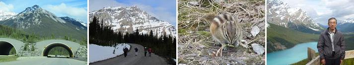
ü@*Mt. Baker(3,172meters):We borrow a rent-a-car and run an ice field park way to link the Jasper to lake Louise from Banffshire. An exclusive passage palces for an animal to cross is built in the middle of the highway. We stopped a car in the parking lot of 105km from Banffshire and we got off and walked the slope towards Bow summit(2,070meters) for ten minutes. A small animal were seen along this way. We overlooked the Peyto lake from the observatory of the Bow summit and enjoyed the beautiful view of Mt. Baker and the emerald-colored Peyto lake. We performed Canadian Rocky drive of 300km in total length from Banffshire to Jasper and looked at the scenery of the neighboring magnificent mountains and we was on the way got off and thoroughly enjoyed beauty of a lake and a waterfall and the ravine. (2012year 12th-15th of June)
ü@*Mt. Oyama(1,252meters):I arrive at Isehara Station of Odakyu and take a bus until Daisen cable. I went to Afuri shrine in the halfway up a mountain using a cable, and walked towards the mountaintop of Oyama for 90 minutes. I came across two Japanese deer on the way. I arrived at the mountaintop. While the neighborhood of mountaintop was easy to be slippery because of snow, but checking crampons step by step after eat "the rice ball", and having taken a ceremonial photograph, and hung to Afuri shrine for 60 minutes, and descended a mountain. I arrived at Afuri shrine and came back to Isehara Station using a cable and a bus. A plum bloomed, and spring approached.(2012year 11th of March)
ü@*Mt. Yasaburo(1,058meters):I arrive at Chuo Line Kofu Station and arrive at Tenjinbashi by a route bus. I enjoyed strangely shaped rocks and Kakuen peak or Senga waterfall while looking at the colored leaves of a maple and a ginkgo. I walked from a panoramic observatory to the Mt.Yasaburo and appeared on the mountaintop of the Mt. Yasaburo whom a big round rock got on when I climbed it along a chain. A vast panorama of 360 degrees was looked at from the mountaintop. After the circumference of the mountaintop took a ceremonial photograph fearfully on a precipice, I started on my way home as a return journey at a place same as an outward trip. I was able to enjoy autumn colored leaves and a scene of nature. (2011year 13th of November)
ü@*Mt. Shibutsu(2,228meters):I got off bus from Joetsu Shinkansen Jomokogen Station in Hatomati pass and started mountain climbing towards Mt. Shibutsu since I purchased a rice ball lunch at about 10:30. I ate one rice ball which I brought because I was hungry on the way at about 12:00. It was 13:00 that I arrived at the top of Mt. Shibutsu. Because I was prohibited from a descent from a mountain to Yamanohana of there, I came back to the original course from the top of Mt. Shibutsu and arrived at Hatomati pass at 15:00. I tasted the grilling fish with salt of the char with beer in Hatomati pass Rest station. I came back to Joetsu Shinkansen Jomokogen Station on Sekigoe traffic bus again in Hatomati pass and started on my way home. (2011year 19th of September)
ü@*Mt. Kirigamine(1,925meters):We arrives at the parking lot in front of Kirigamine Royal-in by car via National highway No. 152, Venus line from Chuo Expressway Suwa IC. We took a walk around a village place of the day lily in a hill of Venus. We stayed overnight at a cottage of the Lake Shinshu Suwa Enryou Heights and, in the cool of the plateau of Shinshu, had the delicious soba which an soba expert made and enjoyed a karaoke afterwards. (2011year 18th-19th of July)
ü@*Mt. Amagi(1,406meters):I arrive at the parking lot in front of the Amagi plateau golf course by privately-owned car via Shonan bypass after cooking a fried egg and rice ball in a house. I change into mountain climbing shoes and leave towards Mt.Banjiro. I arrive at the Mt. Banjiro while the chirping of cicada is intense. I leave towards Mt.Bansaburo after eating only one rice ball which I brought because I learned sense of hunger. It was able to overlook Mt.Fuji from the rocky place on the way. I arrived at the top of the Mt.Bansaburo one and a half hours later and I ate lunch which brought deliciously. I came back to the Amagi plateau golf course via Karesawa turning point. I took four hours by mountain climbing after a long absence, and 20,000 steps were tiring very much on foot. (2011year 10th of July)
ü@*Mt. Asama(2,568meters):It is come by privately-owned car via Joetsu Expressway to Mt. Asama-yama visitor center in the sea level 1,973m. I changed into mountain climbing shoes using a parking lot around the Kurumazaka Pass and started mountain climbing toward the Mt. Kurofu(2,404m). I viewed Mt. Mizunotou(2,202m) and an Asama skiing area and Southern Alps from the halfway up a mountain and ate "the rice ball". I looked at magnificent Mt. Asama from the rock peak of the Mt. Kurofu which was the outer rim of a volcanic crater of Mt. Asama and photographed a souvenir picture. I descended a mountain after this from the Mt. Kurofu and came back to the Kurumazaka Pass. (2010year 6th of November)
ü@*Mt. Tateyama(3,015meters):I got off the bus from Nagano Shinkansen Ueda Station in Ougisawa and fell in a trolley-bus in transfer Kurobe Dam and got on a cable car in transfer Kurobe Flat and went down. I went down next at a broad perspective peak on the ropeway, but was able to be filled with haze without being endowed with weather from here to Tateyama (3,015meters). I went down on the tunnel bus next in Murodo and took a walk to Mikuriga Pond and Hell Valley. I appeared in Bijodaira by bus and went down on the cable car at Tateyama Station. Furthermore, I went down on the bus at Toyama Station. I went to long-cherished Tateyama-Kurobe Alpine Route, but unfortunately was not blessed with weather with Tateyama. (2010year 16th of August)
ü@*Mt. Zao(1,841meters): Mt. Zao is the totally name including Mt. Kumano(1,841m), Mt. Zizou and Mt. Katsuta etc. I got off the bus from Yamagata Shinkansen Yamagata Station at Zao Spa and traversed Mt. Zizou, Mt. Kumano and Mt. Katsuta. It was filled with haze by a strong wind, and 20m ahead was in an invisible state. At Okama lake, I found the timing when haze occasionally disappeared by a strong wind and took a photograph. Arrive at the Mt. Katsuta mountaintop bus stop about 2:00 p.m., and looked for Yamako bus, but there is only on one flight per day by departure from 1:00 p.m.. So I came home since came back adversely on the course , and descended a mountain from the Mt. Zizou, and soaked in footbathing in Zao Spa. (2010year 20th of July)
ü@*Mt. Aso(1,592meters): Mt. Aso is the largest active volcano in Japan, and is among the largest in the world. It stands in Aso Kuju National Park in Kumamoto Prefecture, on the island of Kyushu. Its peak is 1592 m above sea level. The central cone group of Aso consists of five peaks: Mt. Neko, Mt. Taka, Mt. Naka, Mt. Eboshi, and Mt. Kishima. Aso has one of the largest caldera in the world. The caldera has a circumference of around 128 km, although sources vary on the exact distance. (2010year 20th, 21th of May)
ü@*Mt. Daibosatsu(2,057meters): I went by privately-owned car to the upper Nikkawa pass to climb Mt. Daibosatsu and fell at a parking lot and climbed the Daibosatsu pass through fortune Zhuang from the upper Nikkawa pass. I stood in the top of Mt. Daibosatsu via a thunder rock since I ate lunch. Wind blew and was very cold in the ridge to go from Daibosatsu pass to Mt. Daibosatsu. I came back to upper Nikkawa Pass from Mt. Daibosatsu via a Japanese larch ridge. (2010year 25th of April)
ü@*Mt. Tsukuba(877meters): I went from "Tsukuba Station" to the Mt. Tsukuba Shinto shrine entrance by bus to climb Mt. Tsukuba. I aimed at the top of the Mt. Nantaisan (871m) from there and walked. It was wrapped up the day before from the halfway up a mountain by the snow which fell. I go out from the top of the Mt. Nantaisan to Mt. Nyotaisan (877m) through Miyukigahara . After having enjoyed the prospects on the mountaintop, I traced "white cloud bridge course" around the strangely shaped rocks mysterious stone-floored room, "the stand rock course" along the ridge and appeared in the azalea hill. I came back from the azalea hill to "Tsukuba Station" by bus.(2010year 27th of March)
ü@*Mt. Tounotake(1,491meters): I went by bus from Shibusawa Station to climb the Mt. Tounotake and went down at Okura. I aimed at the top of the Mt. Tounotake from there and walked earnestly. I climbed it while checking it step by step not to slip because it was wrapped up from the halfway up a mountain by remaining snow and did not prepare crampons. I had a short rest on the way in a mountain hut, but found wild child Sika Deer near on this occasion. I took times four hours and half from Okura and finally reached the summit. I began a descent from a mountain since I ate "the rice ball", but snow and a slant had a hard time other than sudden sake thought and arrived at Okura for two hours and half later. (2010year 7th of February)
ü@*Mt. Takao(599meters): I climbed suburban Mt. Takao. I visited a shrine for a new year on the way by the House of special remedy in the halfway up a mountain. I use the Omotesando course and arrive at the top. Many mountaineers adopted a break / lunch in the top. I enjoyed the view of the circumference since I ate "the rice ball" which I brought with me. I use the loquat waterfall course to the way home and descend a mountain. I took a time in the loquat waterfall on the way and observed it. (2010year 10th of January)
ü@*Daisetsuzan Volcanic Group Mt.Kuro(1,984meters): I travel for the first time in life in Hokkaido. I thoroughly enjoyed Nature and the contact of the animal. I used the ropeway from the foot of Soun-kyo Gorge which the Ishikari River flowed through and climbed it to the fifth stage of the Mt.Kuro. I was walking the walk course of the fifth stage, and several times came across Hokkaido Chipmunk. Hokkaido Chipmunk flew about it between bamboo leaves and ate "an acorn". I came across Eversmann's Parnassius which was called "the living fossils", but did not come out to a photograph. (2009year 30th of July)
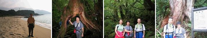
ü@*Yaku Island and ShirataniUnsui Valley(800meters): I did trekking with wife and daughter. The natural rest wood of Yaku cedar primeval forest which applies for about 30 minutes by car from the colony of Miyanoura and spreads near 900m from the altitude of 700m. (2003year September) A walk is taken in sands, and the place that Loggerhead sea turtle lays eggs was seen direct on 18th of September. We did trekking on the ShirataniUnsui valley on 19th of September. Next day's all morning plans stop because of a typhoon, and we catch breakfast in a hotel and check out and are shipped high-speed ship of the Kagoshima line. On consent, by boarding, it is very high, a shake is intense, and a wave arrives in Kagoshima by delay for 1 hour. Kagoshima to Tokyo An airplane reaches operation and safe Haneda beforehand as during scheduled time.
ü@*Mt. Tsubonegadake(1,029meters): The displeased Mt. Tsubonegadake was challenged. (1992year 28th of November) Course:KuwanaüĘ(train)üĘTusincyoüĘ(car)üĘRoute166üĘIIdakacho MiyamaeüĘMt. TsubonegadakeüĘIIdakacho MiyamaeüĘ(car)üĘTusincyoüĘ(train)üĘKuwana
ü@*Okukooti Valley, Mt. Kurusu(1,038meters):I took up a job in Mie leaving my family behind for three years since April, 1991. On the holiday of the company, I tramped over hills with company's people. A mountain could be climbed on the mountain of the beautiful famous place of Japanese pampas grass, the whole distance of Sosa-mura by the side of Nara Prefecture and Misugi-mura by the side of Mie Prefecture could be run, and one day very effective in compensating the daily shortage of physical strength was able to be passed. (1992year 25th of October)
ü@*Mt. Ontake(3,063meters): While reciting "it is pure 6 root" together with a mother and attaching in night using a nature cane, I walked and the mountain of faith "Mt. Ontake" was climbed. The impression when seeing "morning sun" reached from a sea of clouds on a summit still remains in memory clearly. (1966year)
ü@*Mt. Yarigatake(3,180meters), Mt. Sugorokudake: The full-scale mountain was climbed only after accompanying its high school days at mountain climbing of the friends of an elder sister and an elder sister. The summit in Mt. Yarigatake was a narrow sudden inclination, and it reached the summit, following chain. (1964year 20th of July - 23th)
 to HomePage